A dam, not a destination
Most guides to this part of Costa Rica lump the Arenal Dam in with “things to see on Lake Arenal,” and that overstates it. There’s no visitor centre, no guided tour of the turbines, no gift shop, and no ticket to buy. What exists is a working hydroelectric dam with a public road running along its crest, a couple of paved pull-offs where you can safely stop a car, and a view across the water toward Arenal Volcano that’s genuinely worth the two or three minutes it takes to get out and look.
That’s the honest scope of this stop. If you’re expecting an attraction on the scale of the La Fortuna Waterfall or the Mistico Hanging Bridges, you’ll be disappointed — and if you come expecting a quiet, five-minute detour on a longer drive, you’ll be exactly right.
This page covers the dam and its lookout specifically: what it is, why it’s there, and what happened to the valley it flooded. For the lake as a whole — kayaking, windsurfing, the drive around the north shore, Nuevo Arenal and Tilarán — see the Lake Arenal destination page. For the boat crossing to Monteverde, see the jeep-boat-jeep guide linked further down; that route doesn’t actually pass the dam.
What the dam actually is, and why it’s here
The Arenal Dam is a hydroelectric and irrigation dam built and operated by ICE, Costa Rica’s state electricity institute. It was closed in 1979, and the reservoir that formed behind it is Lake Arenal — at roughly 85 square kilometres, the largest lake in the country, and entirely artificial. Before 1979, the valley here held a river system and a scattering of farms and small towns; the dam turned that valley into a body of water deep enough and large enough to run turbines year-round.
The reasoning was practical rather than scenic. Costa Rica’s national grid needed reliable hydroelectric capacity, and this valley — high rainfall, a defined drainage basin, hills on both sides — was a strong candidate for a reservoir. Once full, Lake Arenal became one of the country’s more important sources of hydroelectric power, and the same infrastructure diverts water west through a canal system that irrigates farmland in Guanacaste, a much drier province on the Pacific side. In other words, the lake you might be visiting for kayaking or a lakeside lunch in Nuevo Arenal exists because of a decades-old engineering decision, not a natural depression that filled with rain.
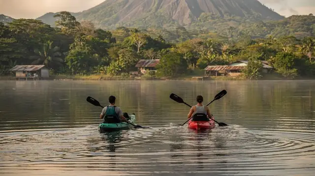
None of that is visible from the lookout in any dramatic way. What you actually see is a long concrete and earthen crest, a narrow two-lane road running across it, and — on a clear morning — the cone of Arenal Volcano rising beyond the water. It’s a good photo, not a museum exhibit.
The villages the lake swallowed
The part of this story worth knowing, and the part most drive-by visitors miss entirely, is what stood here before 1979. The valley that became Lake Arenal wasn’t empty. It held the town of Arenal and the smaller village of Tronadora, both agricultural communities that had existed for generations before the reservoir was planned.
When the dam project moved forward, residents were relocated and both settlements were evacuated and dismantled ahead of the flooding — homes, church, cemetery, all of it. The new town that residents built on higher ground, on what’s now the lake’s north shore, took the name Nuevo Arenal — “New Arenal” — a direct, unsentimental acknowledgment of what had happened. Tronadora’s community also relocated nearby. Today, Nuevo Arenal is a real town with its own restaurants, a central plaza, and a slower pace than La Fortuna, but it carries no visible memory of the original settlement now resting under the lake.
This is the detail that turns a routine engineering fact into something with a bit of weight: every time you look across the water from the dam lookout, you’re looking at a flooded valley that used to be someone’s town. It doesn’t change what you can see today — mostly water and a volcano — but it’s worth knowing before you dismiss this stop as purely technical.
What you’ll actually find at the lookout
Set expectations here deliberately low, because that’s the honest picture. At the dam, you’ll find:
- A paved pull-off wide enough for a handful of cars, usually with room to park safely off the traffic lane.
- A short section of walkable road across the dam crest, with railings on the lake side.
- A view across Lake Arenal toward the volcano, best in the morning before cloud builds up.
- Occasionally, a small stand or a person selling drinks or snacks — this isn’t reliable and shouldn’t be counted on.
- No restrooms, no shade structure, no formal signage explaining the history in detail, and no staff.
That’s it. There isn’t a fenced viewing platform, an interpretive centre, or anything resembling the infrastructure you’d find at a ticketed attraction like Sky Adventures Arenal or the Monteverde Sky Walk. If a tour itinerary or blog post describes the Arenal Dam as a “must-see attraction,” treat that as marketing language rather than an accurate description of what’s on the ground.
Getting there from La Fortuna
The dam sits on the eastern end of Lake Arenal, on the road that continues along the lake’s north shore toward Nuevo Arenal and eventually Tilarán. From La Fortuna, it’s roughly a 20–30 minute drive, and the road is paved the entire way — one of the more straightforward drives in this region, compared with some of the unpaved stretches further along toward Monteverde.
A few practical notes if you’re driving:
- The road narrows in places and crosses some single-lane sections closer to the lake; watch for oncoming traffic and yield signs.
- There’s no dedicated parking lot — just roadside pull-offs, so arrive with realistic expectations about space, especially if you’re in a larger vehicle.
- Fuel up in La Fortuna before you go; options thin out once you’re past the lake’s eastern end.
- If you don’t have a rental car, this stop is difficult to reach affordably on its own. It only really makes sense as part of a longer drive — see Renting a Car for La Fortuna if you’re weighing that decision.
For travelers without a car, this isn’t a practical solo excursion. Public buses run along this road but don’t make dedicated stops for the lookout, and a private taxi round-trip for a 20-minute view isn’t generally good value. It fits naturally into a day that already has you driving this direction — toward Nuevo Arenal, Tilarán, or beyond.
Should you stop here at all
Here’s the honest editorial take: yes, if you’re driving past anyway, and no, if it means a dedicated trip. This isn’t a site that rewards planning your day around it. It rewards being in the car already, on the way to somewhere with more to actually do.
The two situations where it makes sense:
- You’re driving the north-shore road to Nuevo Arenal or Tilarán — for a lakeside lunch, a change of scenery from La Fortuna, or simply to see more of Lake Arenal’s shoreline. The dam is directly on that route, and the stop costs you nothing but a few minutes.
- You have a rental car and want one free, uncrowded viewpoint of the volcano that isn’t a ticketed park entrance. Early morning in dry season, with the cone visible and the water calm, it’s a genuinely nice five minutes.
The situation where it doesn’t make sense: booking a special outing, taxi, or half-day tour specifically to see the dam. There isn’t enough here to justify that cost or time, and you’ll likely leave feeling like you paid for a viewpoint you could have had for free on a drive you were already planning to take. For context on how this compares to the volcano’s more substantial hiking options, see the Arenal Volcano National Park guide — that’s where the “worth planning around” experiences in this area actually are.
What to combine it with
Because the dam is a brief stop rather than a destination, it works best as one stage of a longer day rather than a trip on its own. A few natural pairings:
Heading toward Nuevo Arenal: combine the dam lookout with a wander around Nuevo Arenal itself, and — if you’re up for something more active on that side of the lake — a zipline outing. a canopy zipline tour based in Nuevo Arenal runs above the lake’s north shore and turns a driving day into an active one.
Staying closer to La Fortuna afterward: if the dam is just a short detour before you loop back, pair it with a soak. an admission ticket to Baldi’s thermal pools is a straightforward way to end a driving day, or for something quieter, a forest-and-thermal-wellness combination near La Fortuna blends a short trail walk with hot water.
Continuing on toward Monteverde by road (rather than the boat crossing): the dam sits on the long way around, and if you’re committing to the drive rather than the jeep-boat-jeep option, it’s worth reading Jeep-Boat-Jeep vs. Driving to Monteverde first — the road route takes considerably longer and the dam stop won’t change that math. Once in Monteverde, the hanging bridges and cloud forest circuits are the actual draw; a combined hanging bridges and wildlife visit at Selvatura Park is one way to fill that half of the day.
Planning the bigger picture: if you’re still deciding how the dam fits into a multi-day itinerary, the La Fortuna and Monteverde itinerary and the broader La Fortuna vs. Monteverde comparison are more useful starting points than this page — they’ll tell you whether a lake-shore drive fits your days at all.
Getting oriented before you go
A short list of things worth knowing before you make the drive:
| What | Detail |
|---|---|
| Cost to visit | Free — no ticket, no gate |
| Facilities | None reliable — no restrooms, no shop, occasional informal snack vendor |
| Time needed | 15–30 minutes |
| Best light | Morning, dry season (December–April) |
| Access without a car | Difficult; not served by a dedicated stop |
| What’s actually here | A viewpoint, a walkable dam crest section, interpretive value more than visual spectacle |
If your trip planning already has you weighing how to get from Liberia’s airport to La Fortuna or from San José, note that neither route passes this dam — it’s specifically on the local road connecting La Fortuna to the lake’s north shore, not on the main airport transfer roads.
FAQ: visiting the Arenal Dam
Is there an entrance fee for the Arenal Dam?
No. The lookout and the section of road across the dam crest are free and open to the public. There’s no ticket booth, no visitor centre, and no organised tour of the structure itself.
Can you walk across the dam?
You can walk a short stretch of the road that runs along the top of the dam, where a paved pull-off gives pedestrians a safe place to stop. It’s a five-minute walk out and back, not a hiking trail.
Why was Lake Arenal created?
The dam was built to generate hydroelectric power and to store water for irrigation. Closing it in 1979 flooded a natural basin plus the valley where the villages of Arenal and Tronadora stood, creating the reservoir now called Lake Arenal.
What happened to the town of Arenal?
The original town of Arenal and the nearby village of Tronadora were evacuated and dismantled before the valley flooded in 1979. Residents relocated to higher ground and built Nuevo Arenal, which still stands on the lake’s north shore.
How much of Costa Rica’s electricity comes from Lake Arenal?
Lake Arenal has historically supplied a significant share of the country’s hydroelectric generation, alongside newer wind and geothermal capacity nearby. It also feeds irrigation canals that supply farmland in Guanacaste to the west.
Is the dam on the way to Monteverde?
Only if you’re driving. The dam sits at the lake’s eastern end, on the road that continues along the north shore toward Nuevo Arenal and Tilarán. The jeep-boat-jeep route to Monteverde crosses the lake by boat instead and doesn’t pass the dam.
What’s the best time of day to stop at the dam lookout?
Morning, especially in dry season. Cloud tends to build over Arenal Volcano through the day, so an early pass gives the best chance of an unobstructed view across the water toward the cone.
Is the Arenal Dam safe to visit?
Yes, as a brief roadside stop. The pull-offs are on a public road with ordinary traffic, so treat it like any roadside viewpoint: park fully off the traffic lane, keep an eye on vehicles, and don’t linger on the narrow shoulder sections.