A Town You Pass Through, Not One You Plan Around
Guatuso is the canton seat of the district of the same name, a working town of a few thousand people set in the flat, hot lowlands north of the Tenorio and Arenal volcanoes. If you spend any time on the back roads between La Fortuna and the far north — toward Upala, toward the Maleku indigenous reserve, toward Caño Negro by the long way round — you will drive through Guatuso, or through its satellite village of Katira.
What you won’t do is plan a day of sightseeing here. There is no waterfall, no reserve entrance, no lookout point that puts Guatuso on a typical itinerary in its own right. It’s a fuel stop, a lunch stop, a place to change money or buy a phone card — a hinge point on the map rather than a hinge point in your trip.
That’s not a criticism of the town. Plenty of travelers get frustrated searching for “things to do in Guatuso” and come up empty, because they’ve mistaken a crossroads for a destination. The honest framing is simpler: Guatuso matters because of what’s around it, and because of the road that runs through it. Understanding that early saves you from over-scheduling a stop that was never meant to hold more than twenty minutes.
Where Guatuso Sits, and Why the Road Matters
Geographically, Guatuso canton sits in the plains south of Upala and north of the Tenorio volcano, part of the broader northern lowlands that stretch toward the Nicaraguan border. The town itself is low-lying, warm year-round, and considerably less visited by foreign tourists than Bijagua or Río Celeste, both about forty minutes to the south. Its relevance to a La Fortuna-based trip comes almost entirely from the roads that converge here.
Two routes matter. The first connects La Fortuna to Upala via Guatuso, a back road that skirts the northern edge of the Tenorio Volcano National Park area rather than climbing over it. The second is the local road network linking Guatuso to the villages inside the Maleku territory, which lies a short distance northeast of town. Neither route is a highway.
Expect two-lane pavement that turns to gravel in stretches, occasional potholes, and the one-lane bridges that are common throughout the Costa Rican north — the vehicle facing the CEDA EL PASO (yield) sign gives way, not the other way around. A 4x4 isn’t mandatory to reach Guatuso itself, but it becomes useful the further you push toward Upala or into the Maleku back roads, especially in green season.
The Maleku Territory Is Close, but It’s Its Own Story
The Maleku indigenous territory sits close enough to Guatuso that the two names come up together constantly in trip planning, and it’s worth being precise about the relationship. The Maleku people are Costa Rica’s smallest recognized indigenous group, with a territory made up of a handful of palenques (settlements) northeast of town. Guatuso is the nearest town of any size, and most transport to or from the territory funnels through it — but Guatuso is not the Maleku territory, and a stop in town tells you nothing about Maleku culture, crafts, or community-run visits.
If that’s what you’re after, treat it as a separate decision with its own planning: read the dedicated page on the Maleku indigenous reserve before you go, ideally book through a community-run visit rather than showing up unannounced, and set aside a half day rather than trying to fold it into a Guatuso fuel stop. What’s worth knowing here, on this page, is only the logistics: the turnoff toward the Maleku palenques is signed from the Guatuso area, cell coverage thins out quickly once you leave the main road, and there’s little in the way of restaurants or fuel once you’re off it — top up in Guatuso first.
The Road to Upala: What Guatuso Is a Waypoint For
The second reason Guatuso shows up on maps of this trip is Upala, a larger town about forty minutes further north that serves its own surrounding farmland and, for some travelers, connects onward toward the Nicaraguan border area. Upala has its own page and its own logic — this isn’t the place to plan that leg of a trip — but it’s worth flagging clearly: if Upala is on your route, Guatuso is very likely the last town of any size you’ll pass before you get there, and the last realistic place to fuel up, get cash, or grab a meal before the road narrows further.
Some travelers reach this stretch not by self-driving but on an organized transfer that runs from the San José area up toward Upala with a wildlife stop along the way — useful if you’d rather not navigate the back roads yourself, and a reasonable way to see a working slice of the northern lowlands without renting a 4x4 for it.
a guided transfer from San José toward Upala that breaks up the drive with a stop at the Las Pumas wildlife sanctuaryThat’s a longer-haul option aimed at travelers moving between San José and the far north, not a day trip from La Fortuna — but it illustrates the role Guatuso plays on the map even for people who never plan to stop there deliberately.
What’s Actually in Guatuso Itself
Set expectations low and you won’t be disappointed. Guatuso’s town centre is a modest grid of streets around a central park and church, with a handful of sodas (local eateries) serving casados and fresh juice, a few supermarkets, a couple of banks with ATMs, gas stations on the main routes in and out, and small shops selling everyday goods rather than souvenirs. There’s no boutique hotel scene, no craft market built for visitors, no landmark attraction inside town limits. If you’re driving through around midday, it’s a sensible place to eat a real meal at local prices rather than tourist-menu prices in La Fortuna or Bijagua.
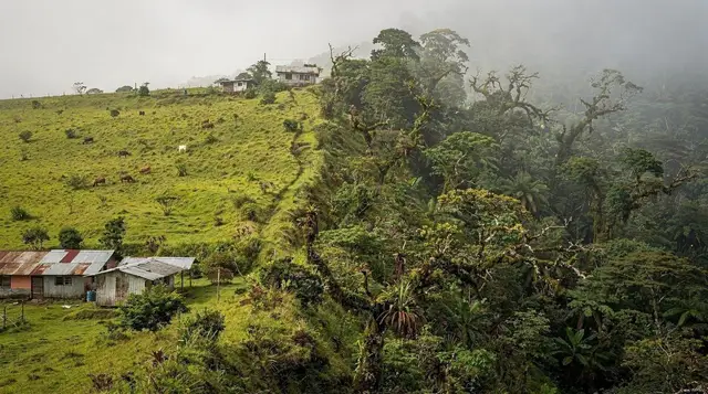
The surrounding countryside is agricultural — cattle ranching and some crop farming dominate the flat land around town — and that has its own quiet appeal for anyone interested in seeing rural Costa Rica away from the tour-bus circuit. Birdwatchers sometimes find the farmland and wetland edges around Guatuso and nearby Katira rewarding precisely because they’re undervisited, though this isn’t a substitute for a dedicated wetland trip to Caño Negro or the Río Frío. If you do have an extra hour and want to slow down here, a walk around the central park, a coffee, and a conversation with whoever’s behind the counter will tell you more about daily life in the northern lowlands than most stops on a typical itinerary.
Practical Notes for Passing Through
A few things are worth knowing before you drive through rather than after you need them. Fuel stations in Guatuso are reliable and generally the last easy option before the road toward Upala thins out, so fill up here rather than assuming you’ll find something further on. ATMs exist in town but shouldn’t be relied on as your only source of cash on a long northern-lowlands loop — carry more than you think you’ll need before you leave La Fortuna or Bijagua. Mobile signal is generally fine in town and patchy once you’re on the smaller roads toward the Maleku palenques or deep into farmland, so download offline maps in advance if you’re self-driving.
Road conditions are the real variable. In dry season (December–April), the main routes through Guatuso toward Upala are manageable in a standard sedan with care. In green season (May–November), sections can turn muddy and potholed, and a 4x4 is genuinely useful rather than a nice-to-have — this is one of the wetter, flatter parts of the country, and rain here doesn’t behave like rain on the Pacific coast. If you’re nervous about self-driving this stretch, it’s a good argument for booking a transfer instead of renting a car for this specific leg of the trip.
| What you might need | Where to get it in Guatuso |
|---|---|
| Fuel | Stations on the main road through town — last reliable option before Upala |
| Cash | A couple of bank ATMs in the centre; don’t count on more than one working |
| A real meal at local prices | Sodas around the central park |
| Phone/data top-up | Small shops in the centre |
| Cell signal | Reliable in town, patchy on back roads toward the Maleku territory |
So, Should You Stop?
If your route takes you through Guatuso anyway — toward Upala, toward the Maleku territory, or looping between Río Celeste and Caño Negro by the inland back roads rather than backtracking through La Fortuna — then yes, stop. Fuel up, eat where locals eat, use the bathroom, and keep moving. Twenty to forty minutes is realistic. If Guatuso isn’t naturally on your route, there’s no reason to detour here specifically; the towns built for visitors, with the infrastructure and activities to match, are Bijagua and La Fortuna, not Guatuso.
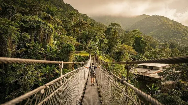
For travelers building out the wider Río Celeste and Tenorio side of a trip, Guatuso is worth knowing about as a piece of the map rather than an entry on the itinerary. The activity worth booking on this side of things is closer to Río Celeste and Bijagua itself: a guided sloth-spotting and hanging bridges walk based in nearby Bijagua and, back down toward the river that gives the whole area its reputation:
a Río Celeste tubing outing that gets you onto the water rather than just alongside itBoth are a more direct use of a day than anything Guatuso itself offers, and both fit naturally into the Río Celeste day trip from La Fortuna or a longer stay based in Bijagua.
Fitting Guatuso Into a Wider Itinerary
Most travelers who pass through Guatuso are doing one of three things: driving the back road from La Fortuna to Upala, looping overland between the Tenorio volcano area and Caño Negro without returning through La Fortuna, or arranging a visit to the Maleku territory and using Guatuso as the practical staging point for fuel and supplies.
In all three cases, the planning question isn’t “what do I do in Guatuso” — it’s “how much time does this detour cost me, and is it worth it.” For a standard La Fortuna and Río Celeste combination, most travelers never need to route through Guatuso at all; the direct road via Bijagua is faster and better served. Guatuso earns its place on the map for the smaller subset of trips that push further north or take the back-roads option deliberately.
If you’re still deciding how many days to give this whole side of the country, it’s worth reading through how many days you actually need in La Fortuna and weighing La Fortuna against Río Celeste as a base before you start plotting detours through towns like Guatuso and Ciudad Quesada that exist to be driven through rather than stayed in.
Guatuso FAQ: What Travelers Actually Ask
Is Guatuso worth a special trip from La Fortuna?
No. Guatuso has no standalone attraction that justifies a dedicated day trip from La Fortuna. It’s useful only as a stop on a route that’s already taking you further north, toward Upala or the Maleku territory, or on a back-roads loop toward Caño Negro.
How do I get to the Maleku indigenous territory from Guatuso?
The Maleku palenques sit a short drive northeast of Guatuso on local roads, signed from the main routes through town. Fuel up and get cash in Guatuso first, since services thin out quickly once you leave the main road, and cell coverage becomes unreliable. Plan the visit itself separately — ideally through a community-run tour — rather than treating it as an add-on to a fuel stop.
Is Guatuso on the way to Upala?
Yes. Guatuso is the last town of meaningful size before Upala on the main northern route, and typically the last practical place to fuel up, withdraw cash, or eat a real meal before continuing.
Do I need a 4x4 to reach Guatuso?
Not to reach Guatuso itself in dry season — the main roads in are paved or well-maintained gravel. A 4x4 becomes genuinely useful if you’re continuing past Guatuso toward Upala or onto the smaller roads near the Maleku territory, particularly in green season (May–November) when sections turn muddy.
Are there hotels in Guatuso?
A handful of basic, locally run options exist for travelers who genuinely need to overnight in the area, but there’s no reason to base a trip here. Bijagua, about forty minutes south, and La Fortuna, further still, both offer far more choice and are built around visitors in a way Guatuso isn’t.
What’s the best time of year to drive through Guatuso?
Dry season, December through April, when the back roads toward Upala and the Maleku territory are easiest to handle. In green season the same routes can turn muddy and slower going, though they remain passable with care and, where needed, a 4x4.
Can I visit Caño Negro from Guatuso?
Caño Negro is reachable from the Guatuso area via local roads, and some travelers use this as an alternative to approaching it from La Fortuna or Los Chiles directly. It’s a longer, less signposted route than the standard approaches, so it suits travelers already in the area rather than being a reason to detour here on its own.
What should I eat if I stop in Guatuso?
Stick to the sodas around the central park for a casado (rice, beans, a protein, salad, and plantain) at local prices — a genuinely useful, unglamorous meal stop if you’re mid-drive and want something better than a gas-station snack.