Why Katira shows up on your map at all
If you’re planning a self-drive loop through Costa Rica’s northern lowlands, you’ll almost certainly see the name Katira on a map or a navigation app somewhere between La Fortuna and Upala. That’s really all Katira is on this site: a landmark you pass, not a place you plan around. It’s a small agricultural community in the canton of San Carlos, set among cattle pasture and plantain farms in the flat country north of the Arenal volcanic corridor, and it has no ticketed attraction, no visitor centre, and no tour that starts or ends there.
We’re covering it anyway, briefly and honestly, because guides that pretend every dot on the map is a “hidden gem” waste your time. Katira’s actual job, for a visitor, is to tell you roughly where you are on the road — a reference point between the volcano country around La Fortuna and the quieter, less-visited towns of Guatuso and Upala further north and west. If you’re driving that stretch, this page tells you what to expect. If you’re not driving that stretch, you can skip Katira entirely and lose nothing.
This page sits in our Río Celeste, Tenorio & Bijagua region because the northern back roads that pass through Katira are also how many travelers connect La Fortuna to Bijagua and the Tenorio volcano area, rather than backtracking through Ciudad Quesada onto the main highway.
What Katira actually is
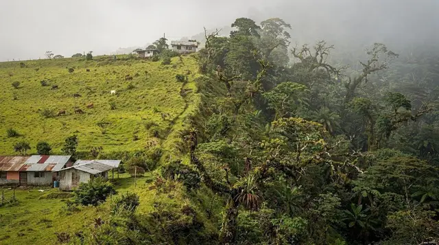
Katira is a rural district built around dairy and beef cattle, plantains, and smaller-scale crop farming — the same economy that defines much of San Carlos canton outside the tourist loop around the volcano. There’s a school, a soccer field, a church, a handful of small general stores (pulperías) and roadside sodas, and houses spread along the road rather than clustered into a dense town centre. None of this is a criticism; it’s simply what a working agricultural community in the Costa Rican interior looks like, and it’s worth seeing precisely because it isn’t staged for visitors.
What Katira is not: it is not a base for excursions, it does not have a hanging bridge, a waterfall, a hot spring, or a wildlife reserve attached to its name, and no legitimate operator runs tours that begin here. If you see a blog or a listing describing a specific “Katira attraction,” treat it with suspicion — we’ve deliberately avoided inventing one, and you should be skeptical of any source that does. The honest version of Katira’s story is that it’s a name on a road sign, and that’s a legitimate thing for a guide to tell you plainly.
The road through Katira
The route travelers use most often runs from La Fortuna north and west through the flatlands toward Guatuso and on to Upala, skirting the northern edge of the Arenal-Tempisque conservation area rather than climbing over it. Katira sits along this corridor. Some sections are paved two-lane road; others narrow to gravel, especially the connectors between smaller settlements.
Expect at least one or two single-lane bridges on this stretch — a recurring feature of northern Costa Rica’s rural road network. The rule is simple and non-negotiable: whichever vehicle reaches the CEDA EL PASO (yield) sign first gives way to oncoming traffic already on the bridge. Nobody enforces this with a light or a guard; it runs entirely on driver courtesy, so slow down well before you can see across.
During the green season (roughly May through November), unpaved sections through this part of San Carlos can turn slick and rutted after heavy rain, and potholes that are a minor annoyance in February can be genuinely rough in September. A 4x4 or high-clearance vehicle is not mandatory for this specific stretch the way it can be for some routes further into the mountains, but it removes a lot of the guesswork, and a standard sedan should go slowly and expect to share the road with farm trucks, cattle occasionally being moved along the shoulder, and cyclists.
| Road condition | What to expect |
|---|---|
| Paved sections | Two-lane, generally in fair condition, occasional potholes |
| Gravel/unpaved sections | Slower going, more pronounced in green season (May–Nov) |
| Bridges | Mostly single-lane; yield to whoever is already crossing |
| Signage | Sparse — a GPS app or offline map is more reliable than signs |
| Fuel stations | Infrequent; fill up in La Fortuna or Ciudad Quesada before setting out |
Who actually drives this way
Three kinds of travelers tend to pass through Katira, and it’s worth being clear about which one you are before you plan around it:
Travelers heading to Upala or Guatuso specifically. These are less-visited towns near the Nicaraguan border, mostly of interest to travelers with a specific reason to go — visiting the Maleku Indigenous Reserve, continuing on to the northern border crossings, or simply exploring off the standard tourist track. If that’s you, Katira is a stretch of road you’ll cover in fifteen or twenty minutes without needing to stop.
Travelers connecting La Fortuna to Bijagua and the Río Celeste area by the northern back road instead of the more common route through Ciudad Quesada. This isn’t usually faster, but some self-drivers prefer it as a loop rather than backtracking the same road twice. If this is your plan, Katira is simply one of the names you’ll see confirming you’re on the right track.
Travelers who typed the wrong destination into a map app. This happens more than guides like to admit. If you’re aiming for Río Celeste, the Tenorio volcano, or the Bijagua sloth sanctuary and your route suddenly takes you through Katira on a route that feels unfamiliar and much longer than expected, double-check your destination pin — some routing engines will send you the long way through the lowlands instead of the more direct road via Muelle.
What to actually do if you’re passing through
Because Katira has no attraction of its own, the practical advice here is short:
- Top up fuel before you leave La Fortuna or Ciudad Quesada. Stations along this corridor are spaced out, and running low on a gravel stretch with no signal is a bad place to discover that.
- Stop at a roadside soda if you want an unstaged meal. These small family-run restaurants serve casados (rice, beans, a protein, and salad) at local prices, generally in colones rather than dollars — a good contrast to the tourist-priced menus around La Fortuna’s centre.
- Don’t expect English. Unlike La Fortuna or Monteverde, where tourism has made English common, communities like Katira, Guatuso, and Upala see far fewer international visitors, and Spanish is the practical default. A few basic phrases go a long way.
- Check your fuel and tyre pressure, not your itinerary. There’s genuinely nothing to schedule here. Treat Katira the way you’d treat any small farming town you drive through on a road trip anywhere in the world: a place to glance at, not a place to plan a stop around.
Distances and drive times from La Fortuna
These are road-trip estimates for the northern lowlands corridor, not fixed schedule times — expect variation with weather, traffic behind farm vehicles, and road work.
| From La Fortuna to | Approximate drive time |
|---|---|
| Bijagua / Río Celeste area | 1.5–2 hours |
| Katira (via the northern back road) | Roughly comparable, on the same corridor |
| Guatuso | Slightly further than Bijagua |
| Upala | The furthest point on this route, well past Katira |
| Ciudad Quesada | About 45 minutes (alternate route via the highway) |
If your actual goal is a specific attraction rather than the town of Katira itself, book your day around that destination and simply note Katira as a marker along the way — not the other way around.
What’s nearby that’s actually worth booking
Because this page exists mainly to keep you oriented, it’s worth pointing toward the parts of this region that do have something to do. The Río Celeste area inside Tenorio Volcano National Park is the headline draw of this whole region — its turquoise water is a genuine optical phenomenon, not a dye, though it clouds over after heavy rain, so build flexibility into your schedule. Nearby Bijagua has become one of the more reliable places in the country to see sloths in the wild, away from the crowds around La Fortuna’s Bogarín Trail.
For travelers who want a structured way to see this side of the region without self-driving every leg, a guided transfer that already threads through this corridor is often the simplest option:
a San José-to-Upala transfer that breaks up the drive with a stop at the Las Pumas wildlife sanctuary covers a version of this same northern route with a scheduled stop built in, which takes the guesswork out of fuel stations and bridge etiquette.
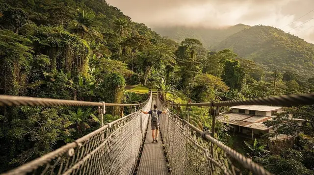
If your actual priority is the Río Celeste side of this region rather than the road itself, most travelers pair it with one active outing nearby. A guided walk across the Heliconias hanging bridges or a tubing run on the Río Celeste itself both start from the Bijagua/Tenorio side rather than from Katira, and both are a far better use of a booked day than anything in Katira proper.
Travelers who’d rather explore the countryside at a slower pace sometimes add a horseback ride through the farmland around Río Celeste, which gives a closer look at the kind of pasture-and-forest landscape you’ll also see driving through Katira, without needing to be behind the wheel.
Planning the rest of your route
If Katira is on your route because you’re building a wider loop, it’s worth deciding upfront whether you’re renting a car for La Fortuna or relying on transfers and organized tours — getting around without a car is entirely possible for the well-trodden sights, but the Katira–Upala corridor specifically is much easier with your own vehicle, since public transport along it is sparse and infrequent.
Either way, it’s worth a look at our travel mistakes to avoid before you set out, since several of the most common ones — underestimating gravel-road drive times, running low on fuel between towns, assuming English will be spoken everywhere — apply directly to a route like this one.
Travelers continuing on toward wetlands and wildlife further north sometimes fold in a stop at Caño Negro on the Río Frío, reachable from this same general corridor; our Caño Negro day trip guide covers that separately, since it deserves its own planning rather than being tacked onto a Katira stop. If your itinerary is still taking shape, our La Fortuna with a rental car itinerary shows how a corridor like this one fits into a longer self-drive loop through the north.
Katira in one sentence
You’ll see the name, you’ll drive past it, and unless you have a specific reason to stop — fuel, food, or simply curiosity about rural San Carlos — you’ll keep going. That’s not a knock on Katira; it’s an honest description of what a waypoint is, and it’s more useful to know that before you leave La Fortuna than to arrive expecting an attraction that isn’t there.
FAQ: driving through Katira on the way to Upala
Is there anything to see or do in Katira itself?
No ticketed attraction, tour, or landmark is based in Katira. It’s a small farming community that functions as a geographic marker on the road between La Fortuna and Upala. Travelers pass through it rather than visiting it specifically.
How long does it take to drive from La Fortuna to Katira?
Expect roughly the same order of time as driving from La Fortuna to Bijagua — around 1.5 to 2 hours — since Katira sits on a comparable stretch of the northern lowlands road corridor. Actual time depends on road conditions and season.
Do I need a 4x4 to drive through Katira?
Not strictly, but it helps. Some sections of this route are unpaved, and conditions get rougher during the green season (May–November) when rain softens the surface. A standard car can usually manage it carefully in the dry season; a 4x4 or high-clearance vehicle gives more margin year-round.
Is Katira a good base for visiting Río Celeste or the Tenorio volcano?
No — use Bijagua or La Fortuna as your base instead. Katira has no lodging infrastructure built around tourism, and it isn’t positioned to make either destination meaningfully more convenient. Bijagua sits much closer to the Tenorio park entrance.
Are there single-lane bridges on the road through Katira?
Yes, and they’re a normal feature of this whole northern corridor, not unique to Katira. Whichever vehicle reaches the yield sign first gives way to traffic already crossing. Slow down before each bridge, since visibility across them is often limited.
Is English spoken in Katira?
Not reliably. Unlike La Fortuna or Monteverde, communities in this part of San Carlos see relatively few international visitors, and Spanish is the practical default in shops, sodas, and along the road. A few basic Spanish phrases are genuinely useful here.
Should I fill up on fuel before reaching Katira?
Yes. Fuel stations along this stretch of the northern lowlands are spread out, and it’s safer to top up in La Fortuna or Ciudad Quesada before setting out rather than counting on finding a station along the way.
Why does this site have a page for Katira if there’s nothing to do there?
Because travelers plotting a self-drive route toward Upala, Guatuso, or the back roads to Bijagua will see the name on their map or navigation app and reasonably wonder what it is. This page exists to answer that honestly rather than to manufacture an attraction that doesn’t exist.