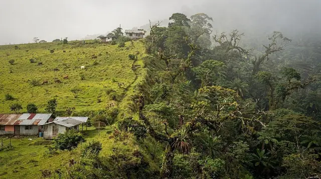
La Fortuna With a Rental Car: A 6-Day Loop
Most visitors to La Fortuna treat it as a base for one-off excursions, booked one at a time and picked up by a shuttle each morning. A rental car turns the same region into a loop: you sleep in different corners of it, drive yourself past the single-lane bridges and roadside sodas, and stop when something looks worth stopping for. This itinerary runs La Fortuna, Lake Arenal and El Castillo first, pushes out to Venado Caves, then swings north to Río Celeste before circling back. It deliberately skips Monteverde — more on why below.
Day 1: Landing and Getting the Car Right
Whichever airport you land at, the drive in sets the tone for the rest of the loop, so it is worth reading how to get from SJO to La Fortuna or how to get from LIR to La Fortuna before you pick up the keys. If this is your first time renting here, our guide to renting a car for La Fortuna covers the insurance add-ons that are worth paying for and the ones that are not.
The single decision that matters most for this itinerary: book a 4x4, not a sedan. Days 2, 4 and 5 all touch unpaved sections, and green season (May to November) is when a two-wheel-drive car gets genuinely stuck rather than just uncomfortable. It costs more per day. Pay it.
Settle into La Fortuna town centre for the evening. If the flight left you tired rather than energetic, the free hot river at El Choyin is a low-key way to end the day — no vestido, no ticket booth, just a warm river under a bridge, though it is worth reading the free hot springs guide first, since bag theft is a real risk there and there is no one watching your things. If you would rather pay for a proper complex on night one, an admission ticket to the multi-pool Baldi complex is a reasonable amount less than Tabacón and closer to town.
Day 2: The Lake Arenal Loop and El Castillo
This is the day that gives the itinerary its shape. From La Fortuna, drive west along the north shore of Lake Arenal — the road hugs the water most of the way, with the volcano’s cone behind you when the clouds allow it. Stop at the Arenal Dam overlook, then continue toward Nuevo Arenal, the relocated town built after the original village of Arenal was flooded when the dam closed in 1979.
Rather than driving the full lake arenal crossing route toward Tilarán, turn back before the lake narrows and take a half-day boat trip across the lake that finishes at a hot springs stop — it is a way to see the lake from the water rather than only from the shoulder of the road, and it books around your own schedule rather than a shuttle’s.
In the afternoon, loop down to El Castillo on the road south of the lake — partly unpaved, which is where the 4x4 starts earning its cost. El Castillo is smaller and quieter than La Fortuna town, worth a stop at the Butterfly Conservatory or, if you have the light for it, the trails at Arenal Observatory Lodge, which sits closer to the volcano than almost any other accessible viewpoint. Overnight in El Castillo or back in La Fortuna, about 45 minutes further.
Day 3: The Volcano on Foot
A full day inside Arenal Volcano National Park, on foot rather than behind the wheel. Start with the 1968 lava trail, which crosses the solidified rock field from the eruption that reshaped this whole area — it is flat, exposed, and hot by mid-morning, so go early. A two-day trail pass covering both the El Silencio and 1968 sectors is worth it if you want to split the walking across two mornings rather than one long one.
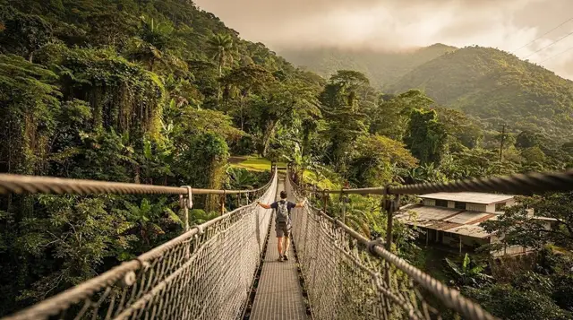
In the afternoon, cross to the hanging bridges. Mistico is the best known of the three parks in this area and easy to confuse with the others, so it is worth a quick read of how the hanging bridges parks compare before you pick. If a guided walk matters more to you than picking your own pace, a guided nature walk across the bridges with a naturalist tends to spot far more wildlife than walking alone.
One thing to be clear about before this day starts: none of this shows lava. The volcano has been dormant since October 2010, and what you are walking across is old, cooled rock — worth it for the scale and the forest, not for anything glowing.
Day 4: Venado Caves and Ciudad Quesada
A shorter drive today, which makes it a good day to slow down. Venado Caves sit about an hour from La Fortuna, reached by a mix of paved and packed-dirt road. The visit itself involves wading and scrambling through limestone passages with a guide, so check what to wear for Venado Caves before you go — closed shoes you don’t mind getting wet, not sandals.
With the rest of the day free, drive to Ciudad Quesada, the working market town of San Carlos canton and a useful contrast to the tourist-facing streets of La Fortuna — it is where locals actually shop, and the central market is a good place for a cheap, unfussy lunch. Return to La Fortuna by late afternoon; this is a lighter day by design, ahead of the longer drive north tomorrow.
Day 5: North to Bijagua and the Edge of Río Celeste
Today the loop turns north, and the roads change character. From La Fortuna, drive via Muelle and Guatuso toward Bijagua — flatter, more agricultural country than the volcano side, with far fewer other tourists on the road. Expect several single-lane bridges on this stretch: whichever car reaches the CEDA EL PASO sign first yields to traffic already crossing from the other side.
Base yourself in Bijagua for the night rather than pushing on to Río Celeste itself — it puts you close to the park entrance for an early start tomorrow, and the town has its own quiet draw. The Bijagua sloth sanctuary has a noticeably better sloth-spotting record than random luck on a rainforest trail, since guides here know exactly where the resident animals tend to be. If you have energy left in the afternoon, the Maleku indigenous reserve is a short detour and one of the few places in this region to learn about the area’s indigenous history directly rather than from a plaque.
Day 6: Río Celeste, Then the Road Back
An early start matters here: the Tenorio Volcano National Park entrance limits daily visitor numbers and closes the trail to new entries in the mid-afternoon, so arriving at opening avoids both the crowds and the risk of being turned away. The hike to the river viewpoints and the Teñidero, where two rivers meet and the water turns turquoise, takes three to four hours round trip on uneven, sometimes muddy terrain.
For something more active before or after the hike, a seven-line zipline circuit near the park is a way to see the same forest canopy from above. Read best time to visit La Fortuna and the notes on rain if you are travelling in green season, since a browned-out river after heavy rain is the single most common disappointment here — not a flaw in the plan, just bad timing that is worth checking for the day before.
From Río Celeste, the drive back to La Fortuna is around an hour and a half, closing the loop. If your flight is out of LIR rather than SJO, this is also the point where it makes more sense to angle toward Liberia directly than to backtrack through La Fortuna first — check your drop-off arrangement with the rental agency before this day rather than on it.
Practical Notes for Driving This Loop
| Stretch | Surface | Where the 4x4 matters |
|---|---|---|
| La Fortuna to Nuevo Arenal | Paved | Not essential |
| Nuevo Arenal to El Castillo | Mixed, partly unpaved | Useful, especially wet |
| La Fortuna to Venado Caves | Mixed | Helpful in green season |
| La Fortuna to Bijagua | Mostly paved | Not essential |
| Bijagua to Tenorio entrance | Unpaved, final stretch | Recommended year-round |
Why Monteverde is not on this loop: the road from La Fortuna, Route 702, takes three and a half to four hours and is unpaved for a long middle section — a full day of driving on its own, not something to bolt onto a morning. Building it into this itinerary would either cut a day from the volcano and Río Celeste side of the trip or turn one already full day into an exhausting one.
If the cloud forest is non-negotiable for you, the La Fortuna and Monteverde itinerary is built around the same self-drive approach and gives Monteverde the two or three nights it needs, rather than squeezing it in here. The alternative some travellers prefer is leaving the car at the lake and taking the jeep-boat-jeep crossing instead, which is faster than driving and doesn’t touch Route 702 at all — though it means arranging a separate vehicle on the Monteverde side.
Río Celeste, Venado Caves and Rental-Car Loop Questions
Do I actually need a 4x4 for this loop?
Not to reach La Fortuna, Lake Arenal or the main entrance to the volcano park, which are all paved. A 4x4 earns its keep on the unpaved stretches toward El Castillo and on the roads north of Bijagua toward the Tenorio park entrance, especially in green season from May to November, when short, hard downpours turn packed dirt into ruts within an hour.
Is the road from La Fortuna to Río Celeste paved the whole way?
Most of it, via Muelle, Guatuso and Bijagua. The final approach into the Tenorio park entrance narrows and roughens for the last few kilometres, with potholes rather than mud in dry season and both in green season. A sedan can usually make it slowly; a 4x4 makes it a non-event.
Can I fit Monteverde into this same rental-car itinerary?
You can, but not as a day trip from this loop. The drive from La Fortuna to Monteverde takes three and a half to four hours over mostly unpaved Route 702, so it needs its own two or three nights rather than a detour. See the La Fortuna and Monteverde itinerary for a version of this same self-drive trip that includes it properly.
What does a CEDA EL PASO sign actually mean on these bridges?
CEDA EL PASO means yield. Many bridges in this part of Costa Rica, including several on the roads around Lake Arenal and north toward Bijagua, are a single lane wide. The vehicle facing the sign gives way to traffic already on or entering the bridge from the other direction — there is no traffic light, so it runs on eye contact and patience.
Do I need to book Venado Caves in advance?
Booking a day or two ahead is safer than booking on arrival, particularly in the December to April high season, since access is guided-only and groups are capped for safety inside the cave system. It is a shorter commitment than most people expect: figure on two to three hours including gear and the walk in.
Is Río Celeste worth the drive if it rained the night before?
It depends how hard. The turquoise colour comes from an optical effect where fine mineral particles scatter blue light at the point where two rivers meet, and heavy rain stirs up sediment that dulls or browns the water for a day or two afterward. Check recent conditions before committing a full day of driving to it.
Where should I return the rental car — La Fortuna or the airport?
Most agencies operating in La Fortuna are set up for one-way returns to SJO or LIR for an added fee, which is usually simpler than doubling back. Confirm the drop-off airport and fee before you book, since LIR is roughly two and a half to three hours from La Fortuna and SJO is about three.
Transfers and transport passes on GetYourGuide
Verified deep-linked GetYourGuide tours. Book through these links and we earn a small commission at no cost to you.
GetYourGuide does not provide a product photo for this activity — the image shows the meeting point, photographed by us.