Walking Across Rock That Went Quiet Half a Century Ago
The 1968 trail is the closest most visitors get to touching the eruption that made La Fortuna famous. It isn’t inside the section of Arenal Volcano National Park that most day-tour buses stop at — it sits in the park’s El Silencio sector, on a cluster of private reserves that border the protected area and sell their own admission separately from the park gate. What you walk on there is real: blocky, solidified lava from the eruption that reshaped this valley on 29 July 1968. What you won’t see is lava itself. That eruption is more than half a century behind us, and Arenal has been fully dormant since October 2010.
This page covers only the El Silencio / 1968 side. If you’re looking for the park’s main entrance, its maintained forest trails, and the newer 1992 flow with its own lookout point, that’s a different sector of the same national park — covered on the main Arenal Volcano page, not here.
Two Sectors, One Volcano, Two Tickets
Arenal Volcano National Park has two hiking areas that get routinely confused, partly because tour operators and blog posts use “Arenal trail” for both.
The Peninsula sector is the park’s official entrance on the northeastern side of the mountain, run directly by the national park service. Its main draw is the 1992 lava flow and its mirador — the last major eruption before the volcano went dormant. That sector is detailed on the Arenal Volcano destination page and the national park guide, not here.
The El Silencio sector, on the southern side near El Castillo, is where the 1968 flow lies. It isn’t run by the park service directly — it’s a set of adjoining private reserves that each sell their own entry ticket, sometimes bundled with a guided walk, a canopy component, or lodge access. That’s the trail this page is about.
If you only have time for one, know what each gives you: Peninsula for the newer flow and the official park infrastructure, El Silencio for the 1968 flow, generally quieter trails, and — on a clear morning — some of the closest unobstructed looks at the cone from ground level.
The Eruption That Left This Ground Behind
On the morning of 29 July 1968, Arenal — until then considered extinct, or at most a minor peak on maps — erupted violently from its western flank. Pyroclastic flows and lava buried the villages of Tabacón, Pueblo Nuevo, and San Luis, killing roughly 87 people. It was the deadliest natural disaster in Costa Rica’s modern history and the moment that put this corner of San Carlos on the map.
What followed was 42 years of near-continuous strombolian activity — glowing lava, ash columns, the nightly show that built La Fortuna’s early tourism industry. That activity stopped in October 2010. Arenal has been quiet since. The rock under your boots on the 1968 trail is that original eruption, cooled, cracked by decades of weather, and increasingly reclaimed by plants — not a live flow, and not a preview of one.
If you came across older material — a blog post, a tour brochure, even a guide’s script — promising a chance to see molten lava here, it’s out of date by well over a decade. The 1968 trail guide and what cloudy Arenal actually looks like are worth reading before you book anything that implies otherwise.
What You Actually Walk On
The terrain is the point here, more than any single viewpoint. The 1968 flow left behind aa-type lava — rough, blocky, sharp-edged rock, distinct from the smoother pahoehoe you might picture from Hawaiʻi. Reserve trails are cut and packed across and around these fields, so you’re not scrambling over jagged rock the whole way, but you are walking beside and occasionally over it for most of the route.
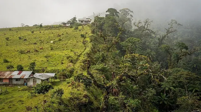
What changes as you move is the vegetation. Sections closer to the original flow’s edge show classic pioneer growth — ferns, mosses, and fast-colonizing shrubs finding cracks in the rock. Further in, older growth has had more decades to establish, and in places the forest has closed back in almost completely over the stone. It’s a slow-motion demonstration of ecological succession that’s easy to miss if nobody points it out, which is one real argument for a guide here over a solo walk.
Openings in the tree line give views up toward the cone itself. On a clear morning — and only then — you get one of the more dramatic close-range looks at Arenal’s near-perfect cone shape, rising 1,670 m above the valley floor, without the crowds of the more heavily marketed viewpoints.
El Silencio Sector vs the Park’s Peninsula Sector
| El Silencio / 1968 trail (this page) | Peninsula sector (park’s official entrance) | |
|---|---|---|
| Managed by | Private reserves bordering the park | Costa Rica’s national park service (SINAC) |
| Lava flow featured | 1968 flow | 1992 flow |
| Ticket | Bought at the reserve, separate from park entry | Bought via SINAC, online reservation recommended |
| Typical crowd | Lighter, especially early morning | Heavier — the default stop for day tours |
| Access point | Near El Castillo, south side | Park’s main gate, northeast side |
| Covered on this site | This page | Arenal Volcano / park guide |
Tickets, Reserves, and How They Differ
Because El Silencio isn’t one government-run entrance, admission isn’t uniform. Several private reserves border the 1968 flow, each with its own gate, its own price, and its own combination of trail length, guiding options, and extras — some pair the walk with a canopy or wildlife-viewing add-on, others keep it to the trail alone. A few properties near Arenal Observatory Lodge offer their own version of lava-field walking as part of a broader trail network — worth checking if you’re already staying or visiting that side.
The practical upshot: don’t assume a ticket to one reserve gets you into another, and don’t assume “the 1968 trail” is a single fixed itinerary. If a set trail and predictable pricing matter more to you than piecing together which reserve does what, a packaged tour removes the guesswork — a guided half-day hike across the 1968 lava trail handles entry and routing for you, and a longer option, a two-day Arenal trails adventure covering the 1968 flow in more depth, suits travelers who want to spend real time on this side of the volcano rather than a single afternoon.
Self-Guided or With a Guide
Trails on the private reserves are marked and walkable without a guide, and that’s a perfectly reasonable choice if your main goal is exercise and a look at the cone. What you lose going alone is interpretation: the succession stages in the vegetation, the safe spots to actually stand close to the rock, and — depending on the reserve — wildlife that a trained eye spots and an unguided visitor walks straight past.
Several operators fold wildlife-spotting into the same outing rather than treating the lava field and the forest canopy as separate products; if spotting a sloth or monkey matters as much to you as the geology, a combined outing like a guided sloth and monkey walk on the Arenal side is worth comparing against a lava-only ticket before you book.
Practical Details: Fees, Hours, What to Bring
| Item | What to expect |
|---|---|
| Entry fee | Roughly USD 15–30 per person, reserve-dependent |
| Typical hours | Morning through mid-afternoon; check the specific reserve, hours vary |
| Trail surface | Packed dirt and gravel with sections of exposed volcanic rock |
| Footwear | Closed shoes with real grip — sandals are a bad idea on this rock |
| Sun and rain | Little continuous shade in open sections; La Fortuna gets rain most afternoons year-round |
| Wildlife precaution | Fer-de-lance (terciopelo) territory — stay on marked trail, never in flip-flops |
| Water | Bring your own; not every reserve has vendors on-site |
None of this requires technical hiking experience. It’s a moderate walk on uneven ground, not a climb.
When to Go for a Clear View of the Cone
Arenal makes its own weather, and cloud cover over the summit is the rule more often than the exception — that holds whether you’re on this trail or any other vantage point around La Fortuna. Dry season, December through April, gives the best odds, and within any given day, early morning beats afternoon: cloud tends to build as the day warms.
September and October, paradoxically drier on Costa Rica’s Pacific coast, are among the wettest months in this northern zone, which argues against banking on a clear-cone trip if you’re traveling then. None of this is a guarantee — see what a cloudy Arenal actually looks like before you set expectations, and read the truth about the “lava” claims if you want the fuller story on why some marketing still oversells this mountain.
Combining the 1968 Trail With Other Arenal Activities
The trail’s location near El Castillo puts it within easy reach of several other stops without much extra driving. A short trip further along the same road brings you to Arenal Observatory Lodge and its own trail network, closer still to the cone. In the opposite direction, El Castillo itself makes an easy lunch stop with mountain-lake views.
For a different angle on the cone entirely — an aerial one, without a hike — an option like an aerial tram ride to the Hand of Arenal viewpoint climbs a nearby ridge for a wide-angle look at the volcano and the lake behind it, and pairs well with a rock-level 1968 trail visit on the same day.
If your day includes hot springs afterward — a natural pairing, given how many springs in this valley trace their heat to the same volcanic system — a combined option such as an Arenal forest escape combining a nature walk with thermal wellness pools lets you end a rock-and-dust morning somewhere warmer and softer.
Travelers deciding how to structure their overall trip should check how many days to allow in La Fortuna and the common mistakes worth avoiding — both are useful before locking in an itinerary, whether that’s a one-day plan that has to be selective or a longer stay with room to slow down.
If Cerro Chato is on your list from an old guidebook, know before you go that its crater hike has been closed since 2018 — see why it’s off-limits — and isn’t a substitute for, or a companion to, this trail. And if you’re relying on a weather app to time your morning, it’s worth reading why the forecast for Arenal is often wrong before you set an early alarm on its word alone. For a broader sense of what volcanic hiking around La Fortuna covers beyond this one trail, the volcano hikes category rounds up the rest.
FAQ: Hiking the 1968 Lava Trail at Arenal
Can you still see lava on the 1968 trail?
No. The flow solidified decades ago and Arenal has been dormant since October 2010. You’re walking on cooled rock, not active lava.
Is this the same as the trail with the 1992 lookout point?
No. This is the El Silencio sector, on private reserves bordering the park. The 1992 flow and its mirador are on the park’s official Peninsula sector, a separate entrance and a separate ticket.
Can I combine the 1968 trail with Cerro Chato?
No. Cerro Chato’s crater lagoon has been closed to hikers since 2018 for erosion and safety reasons, and it has no connection to this trail regardless.
Do I need a guide for the 1968 trail?
Not strictly — the trails are marked and walkable independently — but a guide will point out regrowth patterns, wildlife, and safe viewpoints you’d likely walk past alone.
How difficult is the walk?
Moderate. The path itself is graded and maintained, but the terrain underfoot is uneven volcanic rock, and there are sections with limited shade.
Will I definitely see the volcano’s cone?
No guide can promise that. Arenal’s summit is frequently in cloud, especially by mid-morning and in green season. Early starts in dry season give the best odds.
Is this trail worth it if I already did the hanging bridges?
For most visitors, yes — it’s a different kind of terrain (open volcanic rock rather than forest canopy) and a different story (the 1968 eruption itself).