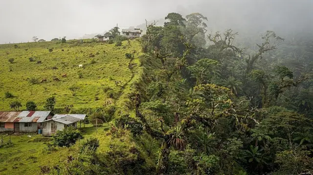
Cerro Chato is the smaller, extinct volcanic cone that rises just south of Arenal, its crater holding a jade-green lagoon that used to be one of the most photographed hikes in the La Fortuna area. It no longer is. Since 2018, the trail to the summit and the lagoon has been closed, and it has stayed closed every year since. This page exists mainly to say that plainly, because a surprising number of tour listings, travel blogs, and even some guidebooks still describe Cerro Chato as a doable half-day hike. It is not. If you came here trying to decide whether to fit the climb into your itinerary, the decision has already been made for you.
What Cerro Chato Actually Is
Cerro Chato sits immediately beside Arenal Volcano, close enough that the two are often photographed in the same frame — Arenal’s sharp, near-perfect cone next to Cerro Chato’s rounder, forested one. Unlike Arenal, Cerro Chato has not erupted in roughly 3,500 years, and its crater has filled with rainwater to form a lagoon ringed by cloud forest. The name translates loosely to “flat hill,” a fair description of its blunter profile next to its younger, sharper neighbor.
For years, that lagoon was the payoff at the end of a steep, muddy scramble that started near the base of Arenal and climbed through dense forest for roughly two to three hours round trip. It was never an easy walk — locals and guides described it as one of the more physically demanding short hikes in the area, with sections of exposed roots and loose volcanic soil that turned to a slide in the rain. That difficulty is part of why it eventually closed.
Cerro Chato lies within the boundaries and buffer zones associated with Arenal Volcano National Park and adjoining private reserves near El Castillo, the same patchwork of land ownership that governs access to the volcano’s older lava trails.
Why the Trail Closed in 2018
Three separate reasons are usually given for the closure, and all three are still true today.
Erosion. The Cerro Chato trail climbs steeply through soft volcanic soil with minimal vegetation cover on the upper slopes. Heavy, near-daily rain on this side of the mountain — La Fortuna sits on the windward side of the cordillera and gets rain in every month of the year — cut the trail into deep, unstable gullies within a few years of heavy foot traffic. Sections of the path were sliding away entirely, taking the safest footing with them.
Accidents. The combination of steep grades, wet clay-like mud, and no maintained handholds led to a rising number of falls and injuries, some serious enough to require evacuation. Search-and-rescue callouts on Cerro Chato became frequent enough that landowners and park authorities stopped viewing the trail as an acceptable risk to keep open.
Land status. The route crosses a mix of private property and protected national park land, without a single managing authority responsible for maintenance, signage, or liability. When the trail became unsafe, there was no clear entity obligated to fix it — so instead, access was closed on both the private and park sides.
Put together, this is not a temporary closure waiting on a permit renewal. It reflects a trail that damaged itself faster than anyone had a mandate to repair it, on land nobody single-handedly controls. There is no active plan to reopen it, and no date circulating for when — or whether — that might change.
The Guides and Blogs Still Getting It Wrong
If you searched for Cerro Chato and found a five-year-old blog post describing “a tough but rewarding two-hour scramble,” you are not imagining things — that content used to be accurate. A lot of travel writing about La Fortuna was published before 2018 and simply never updated. Some tour operators’ old marketing copy has the same problem: pages get indexed, ranked, and never revisited even after the product behind them stops existing.
This matters because Cerro Chato is not a case where a hike is merely unpleasant or overhyped — the trailhead gates are closed, the route is not maintained, and going anyway means trespassing on private land, entering a national park area outside authorized trails, and hiking a genuinely eroded slope with no rescue infrastructure behind you. It is worth treating any listing that still offers a “Cerro Chato hike” as either outdated or, less charitably, misleading.
We cover this same pattern of stale information across the destination in La Fortuna Travel Mistakes to Avoid, and it comes up often enough on its own that we gave it a dedicated page — see Cerro Chato Closed: What to Know for the longer version of this story, including how the closure was communicated locally.
The other recurring piece of misinformation in this part of Costa Rica is the idea that Arenal still produces visible lava. It does not, and hasn’t since 2010 — a separate but related myth we untangle in The Lava Lie About Arenal and in our take on why Cerro Chato is off-limits. Both myths share the same root cause: content written when the facts were different, still circulating as if nothing had changed.
What You Can Still See of Cerro Chato Today
You will not summit it, but Cerro Chato remains visible, and its silhouette shows up in plenty of legitimate activities nearby.
From several viewpoints on the Arenal 1968 Trail — the maintained, still-open lava trail across the solidified 1968 eruption flow — Cerro Chato’s rounded green dome is clearly visible next to Arenal’s cone, without any of the risk or trespassing involved in trying to reach its crater. The trails around the Arenal Observatory Lodge offer similarly wide, legal views of both volcanoes from a comfortable, well-marked network.
a guided walk along the 1968 lava trail is the closest legitimate substitute for a “volcano hike” in this immediate area — it covers the terrain the 1968 eruption actually reshaped, with a guide who can point out where Cerro Chato sits relative to Arenal’s active-era lava flows.
For a different angle entirely, an aerial tram ride up to the Hand of Arenal viewpoint gets you elevation and a wide panorama that typically includes Cerro Chato’s cone in the same frame as Arenal and, on clear days, Lake Arenal beyond it — all without a single step of climbing.
Cerro Chato: Then vs. Now
| Before 2018 | Today | |
|---|---|---|
| Trail status | Open, unofficial but tolerated | Closed, no legal access |
| Typical duration | 2–3 hours round trip | Not applicable |
| Difficulty | Steep, muddy, moderately strenuous | Not applicable |
| What you could reach | Crater rim and lagoon | Nothing — trailhead is closed |
| What you can still see | Same as today | The cone, from a distance, on other trails |
| Managing authority | Disputed private/park boundary | Same dispute, now resolved by closure |
Legal Alternatives Near Arenal
If a volcano hike was the point, these are the trails and activities that are actually open and maintained around La Fortuna right now.
| Activity | Where | Approx. price (USD) |
|---|---|---|
| 1968 lava trail hike | Arenal 1968 Trail | $20–35 |
| Observatory Lodge trail network | Arenal Observatory Lodge | $10–20 entry |
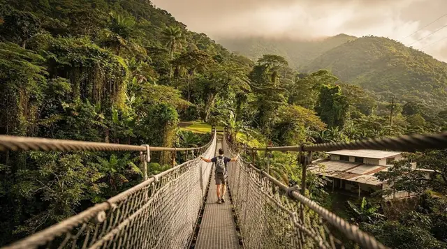
| Hanging bridges walk | Mistico Hanging Bridges | $30–45 |
| Aerial tram to volcano viewpoint | Sky Adventures area | $50–70 |
| Wildlife-focused nature walk | Bogarín Trail | $25–35 |
The 1968 trail in particular is the one most travelers actually mean when they ask about “hiking Arenal” — it crosses the solidified lava field from the volcano’s last major destructive eruption, with none of the erosion or land-access problems that shut Cerro Chato down. We cover it in full in the Arenal 1968 Lava Trail Guide, and the wider Arenal Volcano National Park Guide lays out how the park’s two main sectors — Peninsula and 1968 — actually work, since they’re sold and signed separately.
If wildlife rather than lava fields is the draw, a guided sloth and monkey walk in the forest around La Fortuna delivers what a lot of people were quietly hoping for from a Cerro Chato hike anyway — time in the forest with a naturalist guide, minus the eroded slope. Our wildlife-spotting guide has more on where sightings are actually reliable.
Planning a Day Without Cerro Chato
Because there’s no hike to build a morning around, most travelers fold a Cerro Chato viewpoint into a day that already includes something else — the 1968 trail, the Observatory Lodge grounds, or a hot springs afternoon after a morning walk. A reasonable combination looks like a two- to three-hour guided walk on the 1968 trail in the cooler morning hours, lunch in La Fortuna’s town centre, and hot springs in the afternoon — see the hot springs comparison guide for which complex fits your budget, from the free Río Chollín to paid options like Tabacón.
Budget for a day built this way runs roughly $60 to $150 USD depending on which paid activities and hot springs you add, plus transport. It’s a fuller, more reliable day than the old Cerro Chato hike ever guaranteed — that trail’s payoff, a lagoon view, was never certain even when it was open, since Cerro Chato’s summit sits in cloud cover as often as Arenal’s does.
For a broader sense of how much time to allocate across the region rather than to one closed trail, How Many Days in La Fortuna and our two-day itinerary both assume Cerro Chato is off the table, which keeps the planning realistic. The things to do: volcano hikes category page rounds up every legal option in one place if you’d rather compare all of them side by side.
Frequently Asked Questions About Cerro Chato
Is Cerro Chato open in 2026?
No. The trail to the Cerro Chato crater and lagoon has been closed since 2018 and remains closed. There is no indication of a reopening date.
Why exactly was Cerro Chato closed?
A combination of severe trail erosion from heavy rainfall on volcanic soil, a rising number of hiker accidents on the steep, muddy slopes, and the trail’s location crossing both private land and national park territory with no single authority responsible for its upkeep.
Can I hike Cerro Chato with a local guide instead?
No. Local guides cannot legally lead hikes on a closed trail regardless of experience, and doing so would mean trespassing on private and protected land. Any operator offering this should be treated as either misinformed or dishonest.
Is there any way to see the crater lagoon today?
Not on foot and not legally. There is no aerial tour, drone viewpoint, or alternative access route marketed for the lagoon specifically. The cone itself, from the outside, remains visible from several nearby trails and viewpoints.
What’s the closest legal hike to what Cerro Chato used to offer?
The Arenal 1968 lava trail is the closest match in character — a real volcano-adjacent hike across lava-affected terrain, maintained and open, with guided options available.
Do any blogs or tour sites still list Cerro Chato as open?
Yes, unfortunately. Outdated content from before 2018 is still indexed and circulating. Treat any listing describing an active Cerro Chato hike as unreliable, and check a source’s publish or update date before trusting it.
Is Cerro Chato dangerous to attempt anyway?
Attempting the closed trail means unmaintained, eroded terrain with a documented history of falls and injuries, no official rescue presence, and the legal exposure of trespassing on private and park land. It isn’t a hidden shortcut — it’s a closed trail for concrete safety reasons that haven’t changed.
Will Cerro Chato ever reopen?
There’s no current plan or timeline for reopening. Reopening would require resolving the private/park land dispute and funding significant trail stabilization work, neither of which is underway as of this writing.