Cerro Chato Is Closed: What Actually Happened and Where to Hike Instead
Can you still hike to the Cerro Chato crater lagoon?
No. The trail to the Cerro Chato crater and its lagoon has been closed to hikers since 2018 due to severe erosion, a string of accidents, and its status as private and national park land. No operator, guide, or permit legally puts you on that trail today.
Cerro Chato today: a closed trail, not a hidden gem
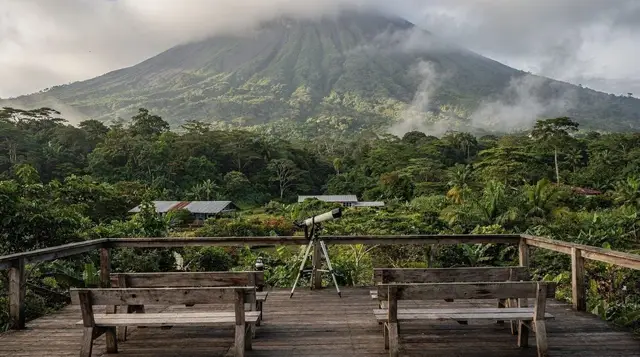
Cerro Chato is the smaller, extinct cone that sits just south of Arenal Volcano, separated from it by a saddle of forest. For years it had a reputation as La Fortuna’s toughest half-day hike: a steep scramble to a crater rim holding a still, jade-green lagoon, with views back across Lake Arenal as the reward. That hike does not exist anymore. Since 2018, the trail to the Cerro Chato summit and crater lagoon has been closed, and it remains closed as of this update in September 2026.
This page exists because that fact has not fully caught up with the internet. Old blog posts, outdated PDFs from long-shuttered tour operators, and aggregator listings that were never taken down still describe Cerro Chato as a bookable activity. It is not. If you are planning a trip to La Fortuna and Cerro Chato is on your list, the goal of this page is simple: tell you plainly that it is closed, explain why, explain why you keep seeing it advertised anyway, and point you toward the hike that actually delivers what people are looking for.
Why Cerro Chato was closed
Three separate problems converged, and any one of them alone would probably have been enough to close the trail.
Erosion. The route to the crater rim climbs a very steep, loosely consolidated volcanic slope — the kind of ground that holds together reasonably well under light use and falls apart under heavy foot traffic. Cerro Chato went from a little-known side hike to a widely recommended one over the course of a few years, and the volume of visitors accelerated erosion on sections of the trail to the point where the path itself became a safety hazard: deep ruts, exposed roots, and slick, undercut ground on the steepest pitches.
Accidents. As the trail degraded, injuries and rescue calls increased. The final stretch to the rim was already a scramble rather than a walk, on rain-slicked volcanic soil, in a district that receives rain in some form on most days of the year. Slips, falls, and people getting stuck or lost after dark were not rare occurrences.
Land status. The trail is not entirely inside Arenal Volcano National Park. Sections cross land adjoining the park boundary, including privately held parcels, without a public right-of-way agreement covering hiker access. That combination — a national park boundary on one side, private land on the other, and no formal access arrangement tying them together — means there is no single authority that can simply reopen the trail by issuing a permit. It would take coordination between the park administration and private landowners, and as of this writing that has not happened.
Put together, the trail was closed to protect both hikers and the land itself, and it has stayed closed because the underlying problems — erosion damage and an unresolved access question — have not been resolved.
Why some tours and blogs still list it
If Cerro Chato is closed, why do you still see it mentioned? A few reasons, none of which mean it is actually available.
- Stale content. A large share of the travel content about Costa Rica online was written years ago and never revisited. A 2016 blog post describing a fantastic Cerro Chato sunrise hike is still indexed by search engines in 2026, sitting right alongside current information, with nothing on the page to flag that the activity it describes no longer exists.
- Aggregator listings. Some directory-style tour sites pull in activity descriptions from wherever they can find them and rarely audit whether the underlying activity is still legally offered. A listing can persist for years after the thing it describes has been shut down.
- Confusion with nearby trails. Cerro Chato sits close to the 1968 lava flow trail and to trails inside Arenal Volcano National Park, and some content simply muddles the two, describing Cerro Chato-style crater views while actually pointing readers toward a different, open trail.
None of this amounts to a loophole. If a listing, a driver, or a blog tells you Cerro Chato is doable, that information is out of date, wrong, or describing a different hike altogether.
The “private guide” myth
This is worth addressing directly, because it is the version of the question we hear most often: can a private, well-connected, or off-the-record guide still take you up Cerro Chato?
No. There is no legitimate mechanism by which a private guide provides legal access to a closed trail that crosses both national park land and private property without a right-of-way agreement. A guide offering this is proposing one of two things: trespassing onto private land, or leading you onto park land outside any authorized route — both of which carry real legal and safety exposure, on ground that is documented to be actively eroding and prone to accidents. This is not a case of a strict rule with a known workaround. Treat any Cerro Chato offer, however confident or “insider” it sounds, as a sign to look elsewhere, not as a special opportunity.
What to do instead
The good news is that the volcanic-hike experience people are actually looking for when they ask about Cerro Chato — a real climb through lava-scarred terrain, with a payoff view of the cone — is available nearby, legally and safely, on the 1968 lava flow trail inside Arenal Volcano National Park.
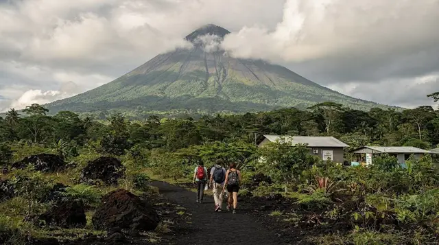
That trail crosses the solidified lava field left by the volcano’s most destructive eruption, on ground that is maintained, marked, and fully within the park’s authorized network. It is covered in full in our 1968 lava trail guide, so this page won’t repeat the details — the short version is that it is the closest legitimate substitute for what Cerro Chato used to offer, and it does not require trespassing on closed or private ground to reach.
a guided hike across the 1968 lava trail covers that same terrain with a naturalist guide who can point out what is otherwise easy to miss in a field of jagged volcanic rock — regrowth patterns, wildlife, and the geology of the 1968 eruption itself.
For a broader volcano hike that isn’t limited to the 1968 flow, a guided Arenal Volcano hike works through the wider park trail network, including forest sections and lookout points toward the cone. If you’d rather combine a shorter walk with a meal stop, a volcano hike paired with a picnic is a gentler way to spend a few hours in the park without the steep scramble the old Cerro Chato route required.
If your interest in Cerro Chato was really about elevated views over the region rather than the crater lagoon specifically, the trails around Arenal Observatory Lodge are also worth a look — covered separately in our Observatory Lodge trails guide — since several of them climb toward lookout points with views across Lake Arenal and the volcano without crossing any closed ground.
Cerro Chato vs. the trails that are actually open
| Status | What it offers | Access | |
|---|---|---|---|
| Cerro Chato crater lagoon | Closed since 2018 | Crater rim, jade lagoon | None — closed to all hikers |
| 1968 lava flow trail | Open | Walk across the solidified 1968 lava field, volcano views | Park entrance ticket, marked trail |
| Arenal Volcano National Park main trails | Open | Forest trails, lava viewpoints, wildlife | Park entrance ticket |
| Arenal Observatory Lodge trails | Open | Elevated lookout points, lake and volcano views | Lodge trail-use fee (day visitors welcome) |
| Mistico Hanging Bridges | Open | Suspension bridges through rainforest canopy, no summit climb | Park entrance ticket |
If you’re planning around this
A couple of practical notes worth keeping in mind while you build out the rest of your trip.
- Don’t let one closed activity derail your itinerary. Cerro Chato was never the only volcano-adjacent hike in the area, and for most visitors the 1968 trail delivers a more interesting walk anyway, since it puts you directly on the lava field rather than a forested approach trail.
- Double-check anything billed as “off the beaten path” near Arenal. Cerro Chato is the most visible example of outdated activity information circulating for this destination, but it’s not the only one. If an offer sounds like insider access to something you can’t find current, official information about, treat that as a reason to ask more questions, not fewer. Our broader rundown of common La Fortuna trip mistakes covers a few more of these.
- Combine your volcano hike with something lower-effort the same day. Many visitors pair a morning on the 1968 trail with an afternoon at the hot springs or a visit to the hanging bridges — a much gentler way to see the forest canopy if your legs are done with steep volcanic ground for the day. A half-day hanging bridges tour fits well into an afternoon slot.
- If you’re building a multi-day plan around Arenal, our La Fortuna for adventure itinerary and two-day La Fortuna itinerary both slot the 1968 trail in as the primary hiking day, without ever assuming Cerro Chato access.
- This isn’t the only Arenal-era myth still circulating. For a broader look at outdated claims about the volcano — including the persistent idea that you can still see lava — see the lava lie about Arenal.
Cerro Chato closure FAQ
Is Cerro Chato open in 2026?
No. The closure that began in 2018 is still in effect. There is no legal way to hike to the crater lagoon, with or without a guide.
Why was Cerro Chato closed?
A combination of severe trail erosion from heavy foot traffic on a very steep volcanic slope, a rising number of injuries and rescues, and the fact that the upper trail crosses private land and Arenal Volcano National Park land without a formal public-access agreement.
Can a private guide take me to Cerro Chato anyway?
No legitimate guide will. Anyone offering a Cerro Chato summit hike is either working from outdated information or proposing an unauthorized, unsafe route onto closed and partly private land. Treat this as a red flag, not a special access opportunity.
Why do some blogs and tour listings still mention Cerro Chato as a hike?
Most of that content predates 2018 and has never been updated. Blog posts, old guidebook PDFs, and tour-aggregator listings tend to stay online indefinitely, and search engines keep surfacing them regardless of whether the activity they describe still exists.
What can I see instead of Cerro Chato?
The Arenal 1968 Trail, on the volcano’s own solidified lava flow, is the closest open hike to what people expect from a Cerro Chato trip: a real climb through volcanic terrain with wide views of the cone. It is open, official, and does not require trespassing.
Is there still a lagoon you can see near Arenal?
Not on foot via Cerro Chato. Some Arenal Observatory Lodge trails and lookout points offer volcano and lake views without crossing into closed terrain, but the Cerro Chato crater lagoon itself is off-limits.
Will Cerro Chato ever reopen?
There is no announced timeline. Reopening would require trail stabilization, a resolved access agreement with the private landowners bordering the park, and a park management decision — none of which has been publicly scheduled as of this update.
Volcano hikes on GetYourGuide
Verified deep-linked GetYourGuide tours. Book through these links and we earn a small commission at no cost to you.
GetYourGuide does not provide a product photo for this activity — the image shows the meeting point, photographed by us.