La Fortuna Travel Mistakes to Avoid
What is the single biggest mistake travellers make in La Fortuna?
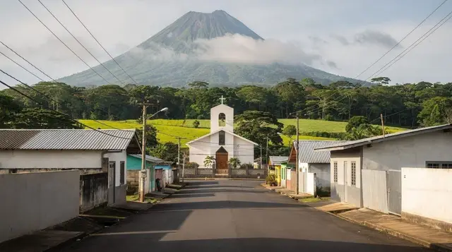
Assuming Arenal Volcano still produces visible lava. It has been dormant since October 2010, after 42 years of near-continuous activity that followed the 1968 eruption. What you actually see today is the cone, the solidified 1968 lava field, and geothermally heated water — not molten rock.
Most of what goes wrong in La Fortuna isn’t bad luck. It’s a small set of assumptions that keep showing up — in guidebooks, in old blog posts, in what a well-meaning friend said about their trip five years ago — that don’t match how the destination actually works today. This page collects the mistakes that recur most often, each tied to a specific, checkable fact rather than a vague warning. For the full detail on any one of them, follow the link to its dedicated guide; this page exists to show the pattern across the whole trip, not to repeat what those pages already cover.
The Lava Myth and Other Arenal Misunderstandings
Expecting to see lava
This is the mistake that shapes every other expectation about La Fortuna, so it goes first. Arenal Volcano erupted catastrophically on 29 July 1968, destroying the villages of Tabacón, Pueblo Nuevo and San Luis and killing roughly 87 people. What followed was 42 years of near-continuous strombolian activity — the glowing cone, the visible flows, the nighttime rumble that older photographs and older articles describe. That activity stopped in October 2010. Arenal has been dormant ever since: no lava, no incandescent rock, no glow on the horizon after dark.
What you can still see is real and worth the trip — the almost perfectly conical 1,670 m cone on a clear morning, the solidified 1968 lava field you can walk across, and the geothermal heat that still warms the region’s hot springs. But a tour, hotel brochure or blog post that promises lava is describing a volcano that hasn’t existed since before most current visitors’ teenage years. The full story, including why the myth persists, is in The Lava Lie About Arenal and the Arenal Volcano National Park guide.
Attempting Cerro Chato anyway
Cerro Chato’s extinct crater lagoon used to be one of the region’s signature hikes — a steep climb rewarded with a swim in a jungle-ringed lake. It has been closed to hikers since 2018, following years of erosion damage and accidents, and because the route crosses both private reserve land and Arenal Volcano National Park boundaries that no longer permit access.
The closure is not a technicality that a persuasive guide can talk their way around; it’s an enforced restriction. Operators and older articles that still list it as a doable half-day hike are wrong, and travellers who try to find an unofficial way in are trespassing on protected terrain. See Cerro Chato: Closed, What to Know before you build a day around it.
Underestimating the waterfall’s 500 steps
La Fortuna Waterfall drops about 70 m into a canyon, and reaching the viewing area and pool means descending roughly 500 steps — then climbing every one of them back out, in tropical heat and humidity. Visitors regularly treat this as a short walk to a photo spot and are caught off guard by how much of a workout the return climb is.
It isn’t dangerous for a reasonably fit adult, but it deserves realistic time and water, not an afterthought squeezed between two other stops. The La Fortuna Waterfall guide covers pacing, timing and what to expect at the bottom; if you’re deciding between this and other falls in the area, Waterfalls Near La Fortuna Compared lays out the alternatives.
Swimming in the current, not the pool
At the base of the falls, the water directly beneath the drop moves fast and the rocks around it are slick with spray — this is not where people swim. The designated swimming area is the calmer pool downstream, reached by a marked path from the base of the stairs. Every year a handful of visitors misjudge this distinction, wade too close to the falling water, and get pulled by a current that looks gentler from a distance than it is up close. Read the layout before you go, not after you’re already standing at the bottom of 500 steps deciding where to get in.
Money, Timing and Logistics Mistakes
Confusing the three hanging bridge parks
La Fortuna has three separate hanging-bridge parks, and their names blur together in a way that causes real booking mistakes: Mistico Hanging Bridges, with six suspension bridges among sixteen total on the lake’s north-west side; Sky Adventures Arenal, which pairs its walk with a tram and zipline circuit; and the Arenal Hanging Bridges park on the park’s Peninsula side. Each has its own ticket, price and set of features, and none of them is simply a cheaper or pricier version of the others.
If you only research “the hanging bridges” as a single generic activity, you can easily book the wrong one for what you actually wanted. Hanging Bridges Parks Compared breaks down the differences properly, and the Mistico Hanging Bridges guide covers the most-booked of the three in detail. A guided run through one of the parks, like this half-day hanging bridges tour, also removes the guesswork by bundling transport and a naturalist guide with the entry.
Paying full price at every hot spring
Tabacón, Baldi and Ecotermales are legitimate, well-run resorts with real infrastructure, and their prices — roughly 40 to 115 USD depending on the property — reflect that. What many visitors don’t realise is that El Choyin, a naturally warm river under a bridge near Tabacón, is free and open to the public, with the same geothermal source, just none of the changing rooms, lockers or supervision.
It’s a legitimate alternative for travellers on a budget, with the honest caveat that unattended bags do get stolen there. Skipping this option entirely, or conversely treating it as a like-for-like substitute for a resort evening, are both mistakes worth avoiding — the Hot Springs Comparison Guide and Free Hot Springs at El Choyin lay out what each option actually gets you.
Treating Monteverde as a quick side trip
The distance between La Fortuna and Monteverde looks short on a map, but the road tells a different story: Route 702 is unpaved for much of its length, and driving it takes 3.5 to 4 hours for about 130 km. The jeep-boat-jeep crossing over Lake Arenal — minibus, boat, minibus — takes roughly 3 hours and usually costs less than a private transfer by road.
Travellers who assume they can drive over for a day trip and back often end up losing most of the day to the road itself. Jeep-Boat-Jeep vs Driving to Monteverde is the single most useful comparison for this decision, and it’s worth reading before you book any Monteverde accommodation or transport.
Skipping the park reservation
Entry to Arenal Volcano National Park, Tenorio Volcano National Park and Poás Volcano is booked in advance through SINAC, the national parks system, and Poás in particular sells out its timed entry slots well ahead of the visit date. Turning up without a reservation and expecting to buy a ticket at the gate is a increasingly common way to lose a planned day. The Poás Volcano day trip guide covers the booking window in more detail.
Carrying only large USD bills
Tours, hotels and park entries in and around La Fortuna are priced and often paid in US dollars, but 50 and 100 USD notes are frequently refused, especially at smaller operators and sodas (local family-run restaurants). Change also tends to come back in colones, sometimes at a rate that favours the vendor. Carrying a mix of smaller USD bills and some colones for local eating avoids both problems.
Chasing quetzals in the wrong town
Resplendent quetzals are one of the most sought-after sightings in Costa Rica, and they are not a La Fortuna bird — they belong to the cloud forest habitat around Monteverde, and are most reliably seen from February to July during their breeding season. Travellers who spend their La Fortuna days scanning the canopy for quetzals are looking in the wrong ecosystem entirely. Quetzals Are Not in La Fortuna explains the mix-up and where to actually look.
Ignoring the rain
La Fortuna sits on the windward side of the country, which means it receives rain in some form throughout the year, typically in the afternoon, regardless of the “dry season” (December to April) versus “green season” (May to November) distinction that applies more cleanly to the Pacific coast. September and October, the wettest months in the northern lowlands, are also among the driest on the southern Pacific coast — a contrast that catches travellers who plan around a single national forecast.
The volcano’s summit is frequently in cloud, especially by mid-morning, so early starts matter for anyone hoping for a clear view. Rainy Afternoons: How to Plan Your Day and Best Time to Visit La Fortuna both go into how to work around this rather than be surprised by it.
Timing the Río Celeste badly
Río Celeste’s famous turquoise colour is an optical effect, not a dye or mineral tint in the way people often assume — aluminosilicate particles suspended at the point where two rivers meet, the Teñidero, scatter light in a way that reads as bright blue. After heavy rain, sediment clouds the water and the colour temporarily disappears, which is the single most common reason visitors come away disappointed. The park also caps daily entries and closes the trail to new entrants in the mid-afternoon, so arriving late in the day risks being turned away entirely.
The Day the Río Celeste Was Brown is a first-hand account of exactly this, and the Río Celeste day trip guide covers timing in more detail. A guided visit, like this Río Celeste and Tenorio National Park tour, also has the advantage of a guide who checks recent conditions before the trip runs.
Wrong footwear on the trails
The fer-de-lance (terciopelo), one of the region’s venomous snakes, is present on forest trails around La Fortuna, and closed, sturdy footwear is a real precaution, not an overcautious suggestion. Sandals or flip-flops on any forest or waterfall trail are a genuine, avoidable risk, not just a comfort issue.
Underestimating gravel roads and single-lane bridges
Travellers who rent a car often plan routes as if every road in the region is paved and every bridge carries two lanes. Neither is reliably true: Route 702 toward Monteverde is unpaved for long stretches, a 4x4 is genuinely useful from May to November, and single-lane bridges are common throughout the northern lowlands, each requiring the driver facing the CEDA EL PASO (yield) sign to stop and let oncoming traffic through first. The One-Lane Bridges That Taught Me to Drive Here and Renting a Car for La Fortuna cover what a rental actually needs to handle here.
Getting tipping wrong
Restaurant bills in Costa Rica already include a 10% service charge and 13% sales tax by law, which leads some visitors to assume no further tip is expected anywhere. For tour guides specifically, a tip of 5 to 10 USD per person per day is standard practice on top of the built-in service charge, and skipping it because “it’s already included” is a mistake guides notice. Tipping in Costa Rica: What I Got Wrong walks through the distinction in more detail.
Building a Trip That Avoids These
None of these mistakes require an expert level of preparation to avoid — most come down to checking a handful of specifics before booking rather than relying on outdated advice or generic assumptions about “a rainforest volcano town.” A well-planned day that sidesteps most of the errors above still leaves plenty of room for the things La Fortuna actually delivers: a real chance at the cone on a clear morning, a genuinely good swim at the base of the falls, and wildlife that’s easier to find than a quetzal ever will be here.
If you’re pairing several of the fixes above into a single well-paced day, a bundled activity like this safari float and hanging bridges tour with lunch or a broader combo adventure day can also simplify the logistics side of it, since transport and timing are handled for you rather than left to guesswork. For a fuller framework on sequencing your days, How Many Days in La Fortuna and the First-Time in La Fortuna Guide are the natural next stops.
FAQ: Avoiding the Most Common La Fortuna Mistakes
Can you still see lava at Arenal Volcano?
No. Arenal’s last strombolian activity was in October 2010. Since then the volcano has been dormant, with no visible lava, no incandescent flows and no nighttime glow. Tours advertising a chance to see lava are describing a version of Arenal that hasn’t existed for well over a decade.
Is Cerro Chato still open to hike?
No. The crater lagoon hike has been closed since 2018 because of erosion, accidents and the fact that the trail crosses both private and national park land. Any operator still selling it as a doable hike is out of date or misrepresenting the activity.
How hard is the walk to La Fortuna Waterfall really?
The descent to the viewing platform and pool is about 500 steps, and every one of them has to be climbed back up in the heat and humidity. It’s not technical, but it is a genuine cardio effort, not a stroll.
Is it safe to swim right under La Fortuna Waterfall?
No. The current directly beneath the falls is strong and the rocks are slick. Swimming happens in the calmer pool downstream, not in the impact zone under the drop itself.
Are Mistico, Sky Adventures and Arenal Hanging Bridges the same park?
No, they are three separate, independently ticketed parks with different bridge counts, locations and add-ons (zipline, tram, canopy walk). Booking one expecting the features of another is a common and avoidable disappointment.
Do all the hot springs in La Fortuna cost money?
No. El Choyin, a warm public river under a bridge near Tabacón, is free and open to anyone, though it has no facilities or security. The paid resorts (Tabacón, Baldi, Ecotermales) add infrastructure, food and safety at a real price difference.
Is it faster to drive to Monteverde or take the jeep-boat-jeep?
The jeep-boat-jeep across Lake Arenal takes about 3 hours and usually costs less than a private transfer. Driving the mostly unpaved Route 702 takes 3.5 to 4 hours for roughly 130 km. Most visitors are better served by the boat crossing.
Why did the Río Celeste look brown instead of turquoise?
The colour is an optical effect caused by aluminosilicate particles suspended where two rivers meet at the Teñidero. After heavy rain, sediment clouds the water and the blue effect temporarily disappears — it isn’t a sign anything is wrong, just bad timing.
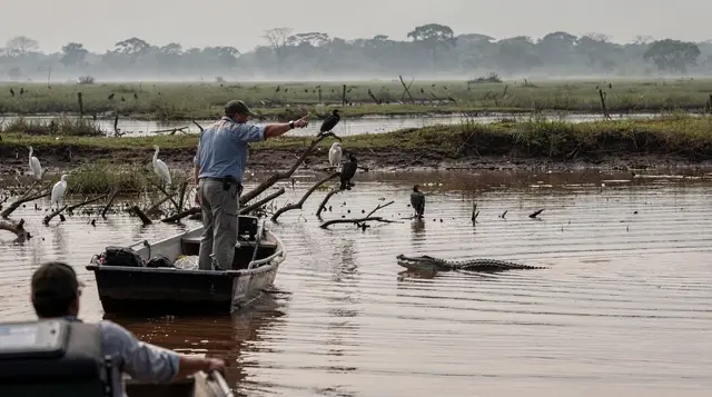
Birdwatching on GetYourGuide
Verified deep-linked GetYourGuide tours. Book through these links and we earn a small commission at no cost to you.
GetYourGuide does not provide a product photo for this activity — the image shows the meeting point, photographed by us.