The Weather App That Lies About the Volcano
The Morning the App Said Sunny
I was on the hotel terrace with coffee, and the forecast on my phone said, in cheerful yellow letters, “Sunny, 27°C.” I believed it, the way you believe a forecast when you’ve paid attention to the radar all week and it’s been more or less right. I looked up at where the volcano is supposed to be. Nothing. Not haze, not a thin veil you could imagine burning off by nine. A flat grey ceiling sitting right where the cone should have been, like someone had erased it out of the photo.
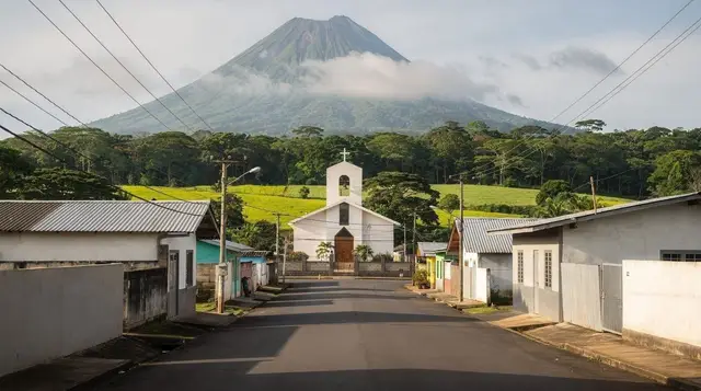
By ten the town itself was glowing. Sun on the plaza, sun on the wet leaves, the kind of light that makes La Fortuna’s little grid of streets look freshly rinsed. I walked down to La Fortuna’s town centre in a T-shirt, sweating lightly, completely cloudless overhead. Fifteen minutes away and about 1,400 vertical metres up, Arenal stayed wrapped in the same grey lid it had worn since dawn. It never came out. Not at noon, not at three, not from the Arenal Observatory Lodge grounds where I drove up hoping altitude would help. The app, all day, kept saying sunny.
It Isn’t a Bug, It’s the Shape of the Mountain
My first instinct, the wrong one, was to go looking for a better app. Something with a finer grid, something that specifically modeled volcanoes, something a guide had sworn by. I tried three over two trips. They agreed with each other about as often as they disagreed with reality.
What eventually stopped me chasing a better forecast was talking to a guide who’d lived under the cone for twenty years. He wasn’t interested in apps at all. He watched the wind. Arenal sits almost alone on the northern plains, a near-perfect cone rising straight out of flat land, catching the moist trade winds off the Caribbean lowlands with nothing to break them first. That air gets forced upward on the windward face, cools, and condenses into cloud that clings to the upper slopes. It’s a standing weather system that the mountain itself creates, hour by hour, independent of whatever synoptic forecast is driving the “sunny” or “rain” icon for the district as a whole.
A weather app has to give La Fortuna one number. One icon for the town at roughly 250 m, covering a district that includes a cone standing at 1,670 m. Those are, in effect, two different climates fifteen minutes apart by road, and the one that decides whether you see the volcano isn’t the one being forecast. This is covered in more depth, with the seasonal patterns and the best viewing windows laid out properly, on our cloud cover expectations guide — this post isn’t trying to replace that, it’s the story of why I stopped trusting the icon.
What I Actually Do Now
I check the forecast for rain, because rain matters for trails and river tours. I’ve stopped checking it for the volcano at all. What I watch instead:
| Signal | What it tells you |
|---|---|
| Time of day | Mornings, roughly before 9am, are consistently the best window before daytime heat builds cloud on the cone |
| Wind at ground level | Stronger wind off the lake often (not always) means more cloud pinned to the summit, not less |
| The cone itself, from town | The only forecast that matters is looking at it |
| Season | Dry season (Dec–Apr) improves the odds, it does not remove this problem |
None of this is a formula. It’s closer to what fishermen do with tide charts: useful patterns, no guarantees. Some of my best mornings for a clear cone have come in July, in the so-called green season, during the brief calm locals call the veranillo. Some of my worst have come in bone-dry February. If you want the fuller seasonal picture, it’s in our best time to visit guide, and if you’re planning around rain specifically, the rainy-afternoon planning guide is more useful than anything a weather icon will tell you.
The Trap I’d Warn You Away From
It would be easy to read all this and think: fine, I just need to download the right app, or ask my hotel for their secret local source. I don’t think that exists, and I’d rather you not spend your trip hunting for it. The unreliability isn’t a data problem. It’s that the thing you actually want predicted, whether a specific cone will be clear at a specific hour, is a microclimate event happening on a single mountain, and no district-level forecast, however finely gridded, was built to answer that question. Ask a meteorologist for a point forecast on a mountain peak and even they’ll tell you the confidence interval is wide.
So I’ve changed what I book around. On my first visit I built an entire day around “the app says clear,” and lost it to cloud that never lifted, feeling robbed of a hike I’d paid for on a promise nobody actually made me. Since then I plan trips that don’t depend on the summit showing itself. Our full-day tour of the waterfall and hot springs below the cloud line doesn’t care what the volcano is doing. Neither does a morning on the
1968 lava trail with a local guide, which walks you through the frozen flow from the 1968 eruption at the mountain’s base — no summit view required, and honestly the geology is the better story anyway.
If you do want to gamble on the view, gamble smart: book a
morning hike to the volcano’s base in the national park rather than an afternoon slot, and treat any glimpse of the cone as a bonus, not the plan. For a wider look at what to actually expect, park sector by park sector, our national park guide covers the practical side, and the park’s own destination page has the layout.
I still check the forecast every morning here, out of habit more than trust. It still says sunny more often than the volcano agrees. I’ve made my peace with that. If you’re planning your own trip, read the best time to visit guide for the seasonal odds, and if you want a longer stay to improve your chances of an uncovered morning, our how many days in La Fortuna guide and the three-day itinerary both build in the slack that a single forecast never will. And if all else fails, there’s a whole park’s worth of
suspension bridges through the rainforest canopy that look just as good under cloud as under sun. First-timers might also want the broader first trip to La Fortuna guide and our list of common travel mistakes, which covers this exact one.
Arenal Cloud Cover and Weather App FAQ
Why does my weather app say sunny in La Fortuna when the Arenal volcano is hidden in cloud?
Weather apps give you one forecast for the town at around 250 m, not for the volcano’s cone at 1,670 m. The summit sits in its own wind-driven microclimate that can stay clouded in all day while the valley below is in full sun, and no forecast resolution fixes that gap.
Is there a more accurate app for Arenal’s summit weather?
Not really. The problem isn’t forecast quality, it’s that a single number can’t describe a cone that generates its own cloud on the windward side while the town fifteen minutes away sits under open sky. Even a hyperlocal model would still be guessing at a system that changes by the hour.
What time of day gives the best chance of seeing the volcano’s cone?
Early morning, generally before 9am, before the day’s heat builds cumulus around the summit. It’s not guaranteed, and the wind can undo it in minutes, but mornings are consistently the better bet.
Does the dry season guarantee clear views of Arenal?
No. La Fortuna sits on the volcano’s windward side, so cloud builds on the cone in both seasons. Dry season improves your odds overall, but a clouded-in summit on a sunny dry-season day is completely normal.
Should I check the forecast before booking a volcano hike?
Check it for rain and general conditions, but don’t use it to predict whether you’ll see the cone. Book tours that deliver value even under cloud, like the 1968 lava trail or the national park’s forest and wildlife, rather than one sold purely on a summit view.
Is it worth staying an extra night just to see the volcano uncovered?
If your schedule allows it, yes, an extra morning meaningfully raises your odds. If it doesn’t, plan your trip so the volcano is a bonus rather than the point, since even a perfect forecast can’t promise it.
Seasonal experiences on GetYourGuide
Verified deep-linked GetYourGuide tours. Book through these links and we earn a small commission at no cost to you.
GetYourGuide does not provide a product photo for this activity — the image shows the meeting point, photographed by us.