San José to Monteverde: The Classic 10-Day Loop
This is the itinerary most first-time visitors to Costa Rica end up building, whether they plan it that way or stumble into it: land in San José, spend the middle of the trip around the Arenal volcano in La Fortuna, cross to the cloud forest at Monteverde, then head on to the Pacific coast and Manuel Antonio for the beach half of the trip.
La Fortuna Trip covers seven regions in the north, and they stop at Monteverde - so this guide walks you through the San José-La Fortuna-Monteverde leg in full detail, day by day, and then hands you off at the point where the route leaves this site’s coverage. If your plan doesn’t include the coast at all, the La Fortuna and Monteverde itinerary covers the same two regions without assuming you’re continuing anywhere.
The route in brief
| Days | Base | What the days are for |
|---|---|---|
| 1 | San José | Land, sleep near the airport or drive straight to La Fortuna |
| 2-5 | La Fortuna | Arenal Volcano National Park, hot springs, waterfall, hanging bridges |
| 6 | Travel day | Jeep-boat-jeep crossing to Monteverde |
| 7-9 | Monteverde | Cloud forest reserves, hanging bridges, night walks |
| 10 | En route south | Departure toward the Pacific coast (outside this guide’s scope) |
Day 1: Landing in San José and the drive north
Most international flights land at Juan Santamaría International Airport (SJO) outside San José, and the drive to La Fortuna from there takes about three hours over mountain roads. If your flight lands in the afternoon or evening, it’s worth spending your first night near the airport in Alajuela rather than pushing straight through in the dark - the road climbs and winds, and headlights on unfamiliar curves are not how you want to start a ten-day trip. See the dedicated guide on getting from SJO to La Fortuna for shuttle, private transfer, and rental car options and roughly what each costs.
If you land early, you can reach La Fortuna by early afternoon and still get a first look at the town before dinner. Either way, day one is a travel day - don’t schedule an activity on top of it.
Day 2: Arenal Volcano National Park and the 1968 trail
This is the day most people picture when they imagine a Costa Rica trip: a near-perfect volcanic cone rising over the rainforest, if the clouds cooperate. They often don’t, especially in the afternoon, so an early start improves your odds of a clear view. Arenal Volcano National Park has two separate trail sectors with separate entrance tickets - the park’s own Peninsula sector, and the privately managed 1968 lava trail, where you walk across the solidified rock field left by the eruption that reshaped this valley.
One honest note before you plan around it: the volcano stopped erupting in October 2010, after 42 years of near-continuous activity following the 1968 eruption that killed roughly 87 people and destroyed the villages of Tabacón and Pueblo Nuevo. There is no lava to see today, at Arenal or anywhere near it - what you’re walking across is the cooled, decades-old lava field itself, which is still worth the trip on its own terms.
this two-day 1968 trails experience bundles the lava field walk with a guided introduction to the park’s wildlife, which is a reasonable way to cover both trail sectors without piecing the day together yourself.
One climb that used to be on every list here no longer is: Cerro Chato, the extinct crater with the lagoon at its summit, has been closed to hikers since 2018 for erosion and safety reasons. If you see it offered as an activity, treat that as outdated.
Day 3: Hot springs and the La Fortuna waterfall
Split this day between the La Fortuna waterfall in the morning and hot springs in the afternoon - the waterfall’s roughly 500-step staircase down (and back up) is easier before the midday heat sets in. The falls drop about 70 meters into a canyon; you swim in the pool downstream of the base, not underneath the falls, where the current is strong.
Hot springs in this area range from free to well over 100 USD, and the hot springs comparison guide breaks down which complexes suit which budget and pace. If you’d rather not spend the money at all, the free river at El Choyín is genuinely warm and genuinely free - just skip the valuables, since it has no lockers or staff. For a paid option with a lower price tag than the well-known resorts, this hot springs day pass is a straightforward way to book ahead for the afternoon.
Day 4: Hanging bridges and a night walk
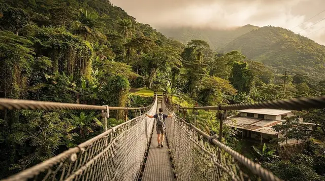
There are several hanging bridge parks around La Fortuna and they get confused constantly, since the names overlap and the routes look similar in photos. Mistico Hanging Bridges on the lake’s northwest side is the best known, with six suspension bridges among sixteen total structures on its trail. this rainforest and hanging bridges tour covers one of these parks with a naturalist guide, which matters here - a trained eye spots far more wildlife along the canopy than you will alone.
Save some energy for after dark. La Fortuna’s night walks turn up frogs, snakes, and insects that never surface in daylight, and they’re one of the better-value evenings in the region for the price. Wear closed shoes; the fer-de-lance is present in this area and sandals are the wrong call on any forest trail here, day or night.
Day 5: A free day around La Fortuna (optional add-ons)
Build in one day without a fixed plan. Weather in La Fortuna is unpredictable in any season - it’s on the windward side of the mountains and gets rain year-round, usually in the afternoon - so a flex day lets you reschedule anything that got rained out earlier in the week. It’s also a sensible day to add one activity you skipped: rafting on the Río Balsa, the Peñas Blancas safari float, the Venado caves, or simply a slower morning in La Fortuna’s town centre before an early night ahead of tomorrow’s travel day.
Day 6: Jeep-boat-jeep to Monteverde
This is the logistical hinge of the whole trip, and it’s worth getting right. The jeep-boat-jeep crossing - a minibus to the shore of Lake Arenal, a boat across the lake crossing, then a second minibus up into the hills - takes about three hours and usually costs less than a private transfer. Driving the same distance by road takes three and a half to four hours over roughly 130 kilometers, a long stretch of it unpaved, with one-lane bridges where you’ll need to check who has the right of way at the CEDA EL PASO sign.
Book the crossing a day or two ahead through your hotel or a local operator; boats run on a schedule, not on demand. Arrive in Monteverde by afternoon and use what’s left of the day to settle in - the temperature drop from La Fortuna is noticeable, and it’s worth having a layer ready.
Day 7: The Monteverde Cloud Forest Reserve
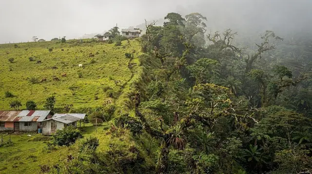
The Monteverde Cloud Forest Reserve, established in 1972 and covering roughly 40 square kilometers, is the reason most people add Monteverde to a Costa Rica trip at all. Mist, moss-covered trees, and a completely different soundscape from the lowlands around La Fortuna - this is cooler, quieter forest, often literally inside a cloud. Go early for the best wildlife activity and the smallest crowds on the trail.
Monteverde was founded in 1951 by a group of Quaker settlers from Alabama, and that history still shapes the village’s low-key, conservation-minded character - it’s a different kind of tourism town from La Fortuna, with less nightlife and more coffee shops.
Day 8: Selvatura, sloths and a second night walk
Monteverde has its own set of hanging bridge and canopy parks, distinct from the ones near La Fortuna. this hanging bridges and sloth-spotting tour at Selvatura Park combines suspension bridges through the canopy with a guided walk aimed specifically at finding sloths, which are genuinely easier to spot with a guide who knows where to look.
Monteverde is also the better bet for birders on this route - resplendent quetzals show up here, not in La Fortuna, and mostly between February and July. If a second night walk fits the schedule, take it; the Selvatura Park area and the reserve edges turn up different species after dark than the daytime canopy tours do.
Day 9: A slow morning in Monteverde, then south
Use the morning for anything you didn’t get to - Curi-Cancha for birdwatching, the Santa Elena reserve, or simply coffee in the village before the next leg of the trip. This is also the day the itinerary leaves the ground this guide covers. From Monteverde, the classic first-timer loop continues toward the central Pacific coast, a drive that takes longer than the map distance suggests once you’re on mountain roads again - the same lesson from the La Fortuna-Monteverde crossing applies a second time here.
Day 10: Where this guide ends - and where Manuel Antonio begins
By day ten on the classic loop, most travelers are arriving at Manuel Antonio on the Pacific coast for the beach half of the trip. That stretch - the coastal drive south from Monteverde, Manuel Antonio National Park, and everything else on the Pacific side - sits outside La Fortuna Trip’s seven regions and isn’t covered on this site. If beach time was never the point and you’d rather spend the back half of your trip inside the region this guide actually covers, the La Fortuna and Monteverde itinerary is built for exactly that: the same volcano-to-cloud-forest route, without an onward leg to plan for.
FAQ: Planning the San José-La Fortuna-Monteverde leg
Does this itinerary cover Manuel Antonio and the Pacific coast?
No. This guide is built around La Fortuna Trip’s seven regions, which stop at Monteverde. The classic first-timer loop continues south to the Pacific coast and Manuel Antonio afterward, but that leg is outside this site’s coverage and isn’t detailed here.
How many days should I spend around La Fortuna before moving on?
Four nights is the practical minimum for the volcano trail, the waterfall, a hot springs evening, and one flex day for weather or an extra activity. Three nights works if you arrive early on day one and don’t mind a tighter schedule.
Is it worth driving to Monteverde instead of taking the jeep-boat-jeep?
For most first-timers, no. The jeep-boat-jeep crossing takes about three hours across Lake Arenal, while the road route runs three and a half to four hours over a long stretch of unpaved road. The boat is also usually cheaper than a private transfer.
Will I actually see lava at Arenal?
No. The volcano’s last eruptive activity was in October 2010, after 42 years of nearly continuous strombolian activity that began with the 1968 eruption. What you can see today is the cone itself when cloud cover lifts, the solidified 1968 lava field on foot, and the geothermal heat that still feeds the region’s hot springs.
Do I need a 4x4 for this route?
A 4x4 is not required for the San José-La Fortuna-Monteverde loop if you take the jeep-boat-jeep crossing, since a boat company driver handles the unpaved sections. If you plan to self-drive the road to Monteverde, high clearance is a real advantage between May and November.
What’s the single biggest planning mistake on this route?
Underestimating how long the roads take. Costa Rica looks small on a map, but mountain roads, one-lane bridges, and unpaved stretches mean every leg takes longer than the straight-line distance suggests - this is especially true continuing from Monteverde toward the Pacific coast, where the terrain gets no easier.
Can I skip La Fortuna and go straight to Monteverde from San José?
You can, but you’d be skipping the country’s most visited adventure base and its hot springs for a shorter trip. Most first-timers do La Fortuna first because it sits roughly on the way and softens the jump into Monteverde’s cooler, mistier cloud forest.
What if I only want the La Fortuna and Monteverde legs, without continuing anywhere else?
That’s a complete trip on its own. See the dedicated La Fortuna and Monteverde itinerary for a version of this route that doesn’t assume onward travel to the coast.
tours.10 days
Verified deep-linked GetYourGuide tours. Book through these links and we earn a small commission at no cost to you.
GetYourGuide does not provide a product photo for this activity — the image shows the meeting point, photographed by us.